King's Nympton

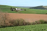
King's Nympton (Latinised to Nymet Regis) is a village, parish and former manor in the North Devon district, in Devon, England, in the heart of the rolling countryside between Exmoor and Dartmoor, some 4½ miles (7 km) S.S.W. of South Molton and 4 miles (6 km) N. of Chulmleigh. The parish exceeds 5,500 acres (2,226 ha) in area and sits mostly on a promontory above the River Mole (anciently the Nymet) which forms nearly half of its parish boundary. In 2021 the parish had a population of 444. Many of the outlying farmhouses date from the 15th and 16th centuries and the village has cottages and a pub, with thatched roofs. Nearly all of its 5,540 acres are given over to agriculture with beef, sheep, dairy, arable and egg production forming the bulk of farming activity.
Excerpt from the Wikipedia article King's Nympton (License: CC BY-SA 3.0, Authors, Images).King's Nympton
North Devon King's Nympton
Geographical coordinates (GPS) Address Nearby Places Show on map
Geographical coordinates (GPS)
| Latitude | Longitude |
|---|---|
| N 50.966666666667 ° | E -3.8833333333333 ° |
Address
EX37 9SS North Devon, King's Nympton
England, United Kingdom
Open on Google Maps


