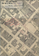
Queensway, Birmingham

Queensway is the name of a number of roads in central Birmingham, England. The name most often refers to the Queensway tunnel, part of the A38. However the name is also used as a suffix of several other roads and circuses, such as Smallbrook Queensway and Colmore Circus Queensway; all of these were once part of the historic A4400 Inner Ring Road, which was often called collectively the Queensway. The Inner Ring Road (i.e. the Queensways) were built as dual carriageway major roads in the 1960s and 1970s. Junctions on the road were largely grade separated, with pedestrians kept physically separate from vehicular traffic and most junctions allowing vehicles staying on the road to pass over or under those using the junction. It is now widely regarded as one of the classic urban planning blunders of the 20th century. Although seen as a revolutionary improvement when the first section opened in 1960, the 'Concrete Collar', as it became known, was viewed by council planners as an impenetrable barrier for the expansion of the city centre. In particular, it became unpopular with pedestrians who were required to use subways at the roundabouts. According to the Birmingham Big City Plan published in 2011, the Ring Road has restricted open spaces, growth and economic activity. It has also made the city centre more crowded and harder to navigate.After 1988, the city council sought to recreate links between the city centre and the neighbouring areas, enlarging the city centre and improving the pedestrian environment across the city, with an emphasis on shifting vehicular movements out to The Middleway. The Inner Ring Road was effectively dismantled by the 2000s - many roads have been rebuilt and downgraded and now far more resemble city streets.
Excerpt from the Wikipedia article Queensway, Birmingham (License: CC BY-SA 3.0, Authors, Images).Queensway, Birmingham
Queensway, Birmingham Ladywood
Geographical coordinates (GPS) Address Nearby Places Show on map
Geographical coordinates (GPS)
| Latitude | Longitude |
|---|---|
| N 52.483 ° | E -1.9026 ° |
Address
Queensway
Queensway
B3 2PB Birmingham, Ladywood
England, United Kingdom
Open on Google Maps


