Battle of Turner's Falls

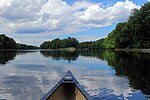
The Battle of Turner's Falls or Battle of Grand Falls; also known as the Peskeompscut-Wissantinnewag Massacre, was a battle and massacre occurring on May 19, 1676, in the context of King Philip's War in what is present-day Gill and Greenfield, across from Turners Falls on the Connecticut River. The incident marked a turning point in the war, and in the colonization of Native lands by British settlers. The war led to the expulsion of most Native Americans in the Connecticut River Valley.A largely untrained, inexperienced militia force of 150-160 engaged in an initial massacre early in the morning around dawn, taking advantage of the native practice of the warriors sleeping in a separate camp during wartime about half a mile away, and began looting of the Peskeompskut camp, killing between 100 and 200 people, mostly women and children. Conducting a fighting withdrawal after the counterattack through ambushes set by the Algonquian tribe's outnumbered warriors, resulting in the deaths of 38 militiamen (including the commander, William Turner) and the wounding of an unknown number. The massacre has been described as genocide. The site of the incident has in recent years been memorialized by the NRHP's establishment as the Riverside Archeological District at the approximate site of the battle.
Excerpt from the Wikipedia article Battle of Turner's Falls (License: CC BY-SA 3.0, Authors, Images).Battle of Turner's Falls
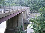
Gill-Montague Bridge,
Geographical coordinates (GPS) Address Nearby Places Show on map
Geographical coordinates (GPS)
| Latitude | Longitude |
|---|---|
| N 42.612865 ° | E -72.549434 ° |
Address
Gill-Montague Bridge
Gill-Montague Bridge
01376
Massachusetts, United States
Open on Google Maps


