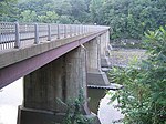
Turners Falls, Massachusetts
1868 establishments in MassachusettsCensus-designated places in Franklin County, MassachusettsCensus-designated places in MassachusettsHistoric districts on the National Register of Historic Places in MassachusettsMassachusetts populated places on the Connecticut River ... and 5 more
Montague, MassachusettsNRHP infobox with nocatNational Register of Historic Places in Franklin County, MassachusettsSpringfield metropolitan area, MassachusettsUse mdy dates from July 2023

Turners Falls is an unincorporated village and census-designated place in the town of Montague in Franklin County, Massachusetts, United States. The population was 4,512 at the 2020 census. It is part of the Springfield, Massachusetts Metropolitan Statistical Area. Its name is sometimes used as a metonym for the entire town of Montague, for which it is the business district and comprises more than half the population.
Excerpt from the Wikipedia article Turners Falls, Massachusetts (License: CC BY-SA 3.0, Authors, Images).Turners Falls, Massachusetts
Crocker Avenue,
Geographical coordinates (GPS) Address Phone number Website Nearby Places Show on map
Geographical coordinates (GPS)
| Latitude | Longitude |
|---|---|
| N 42.598888888889 ° | E -72.556944444444 ° |
Address
Sheffield Elementary School
Crocker Avenue 43
01351
Massachusetts, United States
Open on Google Maps


