place

Stoneleigh-Burnham School

Educational institutions established in 1869Girls' schools in MassachusettsGreenfield, MassachusettsNew England
Stoneleigh Burnham School campus aerial

Stoneleigh-Burnham School (SBS) is a boarding and day school for girls in grades 7–12 and postgraduate year (PG Year). Founded in 1869, the school is the result of the merger of five founding schools. At present, the School is located on a 100-acre (0.40 km2) campus in Greenfield, Massachusetts, United States, in the Pioneer Valley of New England in close proximity to the Five College Consortium. SBS is affiliated with the International Coalition of Girls' Schools (ICGS), the National Association of Independent Schools (NAIS), the Association of Independent Schools in New England (AISNE), The Association of Boarding Schools (TABS), the Parents League of New York (PLNY), the Debating Association of New England Independent Schools (DANEIS), and the Interscholastic Equestrian Association (IEA).SBS is accredited by the New England Association of Schools and Colleges (NEASC).

Excerpt from the Wikipedia article Stoneleigh-Burnham School (License: CC BY-SA 3.0, Authors, Images).

Stoneleigh-Burnham School
Bernardston Road, Greenfield

Geographical coordinates (GPS) Address Phone number Website External links Nearby Places
placeShow on map

Wikipedia: Stoneleigh-Burnham SchoolContinue reading on Wikipedia

Geographical coordinates (GPS)

Latitude Longitude
N 42.6146 ° E -72.5858 °
placeShow on map

Address

Stoneleigh-Burnham School

Bernardston Road 574
01301 Greenfield
Massachusetts, United States
mapOpen on Google Maps

Phone number

call+14137742711

Website
sbschool.org

linkVisit website

linkWikiData (Q7619256)
linkOpenStreetMap (29857358)

Stoneleigh Burnham School campus aerial
Share experience

Nearby Places

Main Street Historic District (Greenfield, Massachusetts)

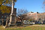
The Main Street Historic District encompasses the civic core of Greenfield, Massachusetts, the county seat of Franklin County, Massachusetts. The district includes several blocks of Main Street extending roughly from Chapman Street in the west to Franklin Street in the east, as well as a number of properties facing the common along Bank Row, south of Main Street, and is architecture reflective of the city's 19th-century growth as a major crossroads and county seat. The district includes the town hall, county courthouse, several 19th century bank buildings, and three properties previously listed on the National Register of Historic Places: the Garden Theater Block, the Leavitt-Hovey House (which houses the public library), and the 1915 Post Office building. The district was listed on the National Register of Historic Places in 1988.Greenfield was settled in the 17th century as part of Deerfield, and was incorporated as a town in 1775. The town center was by then already established on Main Street, with a variety of businesses and residences, none of which have survived. Major travel routes, both north–south and east–west, where developed in the late 18th century that met there. The town became the shire town of Franklin County when it was established in 1811, and a series of civic buildings took shape thereafter in the Bank Row/Court Square area. Commercial development extended east from that area as the 19th century progressed, although a few older homes survived this process, including the Leavitt-Hovey House. Further development was spurred by the arrival of railroads in the mid-19th century, and the late 19th century was the town's period of greatest industrial and economic growth.