place

Dawnsong

2008 establishments in Indiana2008 sculpturesAluminum sculptures in IndianaBicycle parkingIndianapolis Art Center artworks
Interactive artKinetic sculptures in the United StatesOutdoor sculptures in IndianapolisShelters built or used by animalsSteel sculptures in IndianaUrbanization

Dawnsong is a public artwork by American artist Brose Partington, located at Indianapolis Art Center in Indianapolis, Indiana, United States. Dawnsong was installed as part of the Center's ARTSPARK initiative.

Excerpt from the Wikipedia article Dawnsong (License: CC BY-SA 3.0, Authors).

Dawnsong
Rock Creek Church Road Northwest, Washington Fort Totten

Geographical coordinates (GPS) Address Nearby Places
placeShow on map

Wikipedia: DawnsongContinue reading on Wikipedia

Geographical coordinates (GPS)

Latitude Longitude
N 38.946841666667 ° E -77.011755555556 °
placeShow on map

Address

Saint Pauls Church

Rock Creek Church Road Northwest
20011 Washington, Fort Totten
District of Columbia, United States
mapOpen on Google Maps

Share experience

Nearby Places

Fort Totten (Washington, D.C.)

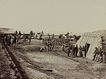
Fort Totten is a neighborhood located in Ward 5 of Northeast Washington, D.C. Fort Totten is located between Riggs Road N.E. to the north, Bates Rd N.E., Allison Street N.E., and the southern end of Fort Totten Park to the south, the Washington Metro Red Line tracks to the east, and North Capitol Street NW to the west. The Washington Metro's Green Line tracks also go through the Fort Totten neighborhood through a tunnel that goes through Fort Totten Park when traveling between the Fort Totten and Georgia Avenue-Petworth Metro Stations. Fort Totten borders the adjacent neighborhood of Riggs Park in Ward 4 of Northeast Washington D.C., Queens Chapel and Michigan Park in Ward 5 of Northeast Washington D.C., Brightwood Park and Petworth in Ward 4 of Northwest Washington D.C. Fort Totten is close to the Catholic University of America, Providence Hospital, Armed Forces Retirement Home, Rock Creek Cemetery, President Lincoln's Cottage, and Soldiers' Home Cemetery. The Fort Totten neighborhood of Washington, D.C. is named after a Civil War-era fort built by General Joseph Gilbert Totten, the Chief Engineer of the antebellum United States Army. Residents of Fort Totten not only have access to Fort Totten Park, but also to the Washington Metropolitan Branch Trail which runs all the way from the Silver Spring Metro Station to Washington Union Station in the Capitol Hill neighborhood of Washington, D.C. Residents who live in the Fort Totten neighborhood have access to the Fort Totten Metro Station, which has primarily been served by the Red Line since the station first opened on February 6, 1978, as well as the Green Line which has been serving the station since December 11, 1993, and the Yellow Line, which has been serving the station since May, 2006. In addition to these Metrorail Lines, residents of Fort Totten are also served by many Metrobus routes as well.