place

Hesperange

AlzetteCommunes in Luxembourg (canton)HesperangePages including recorded pronunciationsPages with French IPA
Pages with Luxembourgish IPAPages with disabled graphsTowns in Luxembourg
Hesperange 02
Hesperange 02

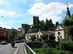
Hesperange (French pronunciation: [ɛspəʁɑ̃ʒ]; Luxembourgish: Hesper [ˈhæspɐ] ; German: Hesperingen) is a commune and town in southern Luxembourg. It is located south-east of Luxembourg City. The total population of the commune is 14.701 people. This breaks down into 6.909 Luxembourgers, 2.021 French, 1.758 Portuguese, 1.052 Italians, 627 Belgians, 514 Germans, 241 Spanish, 207 British, 190 Polish, 106 Dutch, and 1.076 persons of other nationalities. (2014 official data) As of 2008, the town of Hesperange, which lies in the centre of the commune, has a population of 2.651. Other towns within the commune include Alzingen, Fentange, Howald, and Itzig. Each of these five towns has a population of over 1,000, making Hesperange unique amongst Luxembourgish communes in having five towns with over a thousand inhabitants (see: List of towns in Luxembourg by population). Hesperange Castle, now a ruin, has a history dating from the 13th century.Hesperange has a park called Hesper Park which has a memorial commemorating the death of three American soldiers who died in a tank accident on the nearby bridge over the Alzette river on 26 December 1944 during the Battle of the Bulge.

Excerpt from the Wikipedia article Hesperange (License: CC BY-SA 3.0, Authors, Images).

Hesperange
Rue de Bettembourg,

Geographical coordinates (GPS) Address Nearby Places
placeShow on map

Wikipedia: HesperangeContinue reading on Wikipedia

Geographical coordinates (GPS)

Latitude Longitude
N 49.5708 ° E 6.1514 °
placeShow on map

Address

Rue de Bettembourg

Rue de Bettembourg
5862
Luxembourg
mapOpen on Google Maps

Hesperange 02
Hesperange 02
Share experience

Nearby Places

Victor Bodson Bridge

The Victor Bodson Bridge (Luxembourgish: Victor-Bodson-Bréck; French: Pont Victor Bodson; German: Victor-Bodson-Brücke) is a cable-stayed bridge in Hesperange, in southern Luxembourg. It circles the south-eastern suburbs of Luxembourg City, and carries the A1 motorway between Howald and Itzig, over the Alzette valley below. The bridge was completed in 1993, as part of the extension of the A1 from Senningerberg (serving Luxembourg Airport) to the south of Luxembourg City. The bridge is 260 metres (280 yd) long, and stands 40 metres (44 yd) above the level of the Alzette below. The bridge is a total of 27 metres (30 yd) wide, consisting of two lanes running in each direction, separated by a central reservation, along with two emergency pavements.Because the valley under the bridge is inhabited, the design was limited to a single support pillar, located exactly in the middle of the bridge. The bridge is stayed by a single suspension mast, located above the support pillar and from which radial cables fan out along the length of the bridge. Despite its reliance on a single mast for suspension, the bridge is notable for being curved along its entire length.The bridge is named after Victor Bodson, a government minister in the 1940s and 1950s that held responsibility for Public Works, Transport, and Justice. He was also a recipient of the Righteous Among the Nations award for his participation during the Holocaust in helping Jews escape persecution.

Howald
Howald

Howald (Luxembourgish: Houwald) is a town in the commune of Hesperange, in southern Luxembourg. The town merges almost seamlessly with Luxembourg City's south-eastern suburban quarter of South Bonnevoie, which lies to the north of Howald. As of 2006, the town has a population of 4,760, making it the most populous town in the commune and the 22nd-most populous in Luxembourg. Through Howald runs the route de Thionville, one of Luxembourg's historically most-important roads, which runs from Luxembourg City to the French town of Thionville (which had been a part of Luxembourg until 1659). However, for cross-border travel, this has since been supplanted by the A3 motorway, which connects the same two cities via Bettembourg and Dudelange, and the northern terminus of which is just to the west of the town, on the other side of the railway track. From 20 February 1882 until 22 May 1955 a steam railway line from Luxembourg to Remich ran alongside the route de Thionville through Howald. The train was affectionately referred to as the "Jangeli", a name evoking the sound that the train made. The name Jangeli is still maintained as the bus stop location on the Route de Thionville in Howald. Howald's role as a suburb of Luxembourg City is highlighted by the town's youth. As recently as 1885, the town had a population of only 21 people. Even until the Second World War, the town was limited almost exclusively to lining the sides of the route de Thionville. However, since the 1960s, the creation of two development zoning areas, on either side of the route de Thionville, has seen the town expand dramatically, such that it is now the largest town in the commune of Hesperange.