place

Limeburners Bay

Bays of Victoria (state)Geography of GeelongImportant Bird Areas of Victoria (state)Melbourne geography stubsPort Phillip
Ramsar sites in AustraliaUse Australian English from June 2014
Limeburnersbay entrance

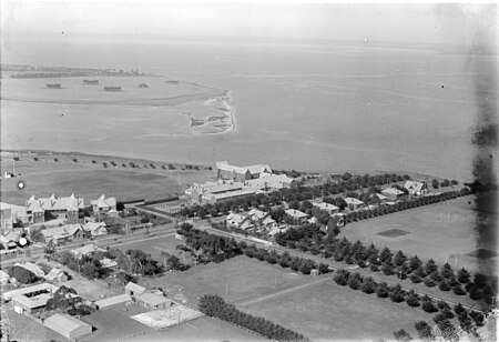
Limeburners Bay, one of numerous bays in Port Phillip, lies in the southwest and adjoins Corio Bay, which abuts Geelong, the second largest city in Victoria, Australia. The bay was named after lime kilns, located on the east side of Corio Bay, used to burn limestone for making cement. In the 1820s, explorers Hume and Hovell ended their journey in the area of Limeburners Bay before returning to Sydney. It is a tide-dominated estuary that runs off Hovells Creek. The area is popular for recreational fishing and hiking and birdwatching. Geelong Grammar School overlooks the bay. Limeburners Bay is home to many endangered species. It forms part of the Port Phillip Bay (Western Shoreline) and Bellarine Peninsula Ramsar Site as a wetland of international importance. The site is part of the Werribee and Avalon Important Bird Area, identified as such by BirdLife International because of its importance for wetland and waterbirds as well as for orange-bellied parrots.

Excerpt from the Wikipedia article Limeburners Bay (License: CC BY-SA 3.0, Authors, Images).

Limeburners Bay
Hovell Creek Trail, City of Greater Geelong

Geographical coordinates (GPS) Address Nearby Places
placeShow on map

Wikipedia: Limeburners BayContinue reading on Wikipedia

Geographical coordinates (GPS)

Latitude Longitude
N -38.075 ° E 144.407 °
placeShow on map

Address

Hovell Creek Trail
3212 City of Greater Geelong
Victoria, Australia
mapOpen on Google Maps

Limeburnersbay entrance
Share experience

Nearby Places

Corio railway station

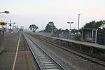
Corio railway station is located on the Warrnambool line in Victoria, Australia. It serves the northern Geelong suburb of Corio, and it opened on 15 September 1890 as Cowie's Creek. It was renamed Cowie on 9 May 1904, and renamed Corio on 1 December 1913.A siding just north of the School Road level crossing was opened in April 1912, and a tramway was constructed from there to the new Corio site of Geelong Grammar School, to facilitate the carting of building materials. At the end of 1913, the station was moved 400 metres down the line, in conjunction with the establishment of a crossing loop on the single track. The relocation of Geelong Grammar School to its new site on 8 January 1914 helped to further increase the station's importance. A station-master's residence was constructed, and a station-master and assistant station-master were appointed.In the early 1950s, Corio's role was boosted by the construction of the Shell Geelong refinery, with its associated sidings, immediately adjacent to the station. In February 1959, the line from North Geelong to Corio was duplicated. When duplication was extended to Lara on 9 September 1981, a new island platform and station building were provided.In 1964, flashing light signals were provided at the School Road level crossing, located nearby in the up direction of the station, with boom barriers provided later on in 1981.On 4 January 2001, Corio was de-staffed.The Western standard gauge line to Adelaide runs immediately west of the station. Although located in Corio, the station is situated about a kilometre from the nearest residential developments in the area.