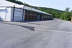
Whitworth, Lancashire
Civil parishes in LancashireGeography of the Borough of RossendaleTowns in LancashireUse British English from February 2012

Whitworth is a town and civil parish in Rossendale, Lancashire, England, amongst the foothills of the Pennines between Bacup, to the north, and Rochdale, to the south. It had a population of 7,500 at the 2011 Census.Whitworth spans the Whitworth Valley, a 7 square miles (18.1 km2) area consisting of Healey, Broadley, Whitworth, Facit and Shawforth, linked by the A671 road. Several smaller hamlets are now part of Whitworth, such as Cowm Top, which was removed to make way for Cowm Reservoir.Whitworth is twinned with Kandel, Germany.
Excerpt from the Wikipedia article Whitworth, Lancashire (License: CC BY-SA 3.0, Authors, Images).Whitworth, Lancashire
Cockhall Lane, Borough of Rossendale Facit
Geographical coordinates (GPS) Address Nearby Places Show on map
Geographical coordinates (GPS)
| Latitude | Longitude |
|---|---|
| N 53.663 ° | E -2.177 ° |
Address
Cockhall Lane
Cockhall Lane
OL12 8BQ Borough of Rossendale, Facit
England, United Kingdom
Open on Google Maps


