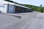
Brown Wardle Hill
Greater Manchester geography stubsHang gliding sitesLancashire geography stubsMountains and hills of Greater ManchesterMountains and hills of Lancashire

Brown Wardle is a hill between the village of Wardle, Greater Manchester and the town of Whitworth, Lancashire, England. The summit is on the border of Greater Manchester and Lancashire and stands 400 m (1,312 ft) above sea level, making it one of the highest points in Rochdale and Greater Manchester. It forms part of the South Pennines, lying within the historic county boundaries of Lancashire.
Excerpt from the Wikipedia article Brown Wardle Hill (License: CC BY-SA 3.0, Authors, Images).Brown Wardle Hill
Geographical coordinates (GPS) Address Nearby Places Show on map
Geographical coordinates (GPS)
| Latitude | Longitude |
|---|---|
| N 53.664680555556 ° | E -2.1543305555556 ° |
Address
Syke
OL12 9TF , Syke
England, United Kingdom
Open on Google Maps


