place

Docklands Studios Melbourne

2004 establishments in AustraliaAustralian film studiosBuildings and structures completed in 2004Buildings and structures in the City of Melbourne (LGA)Television studios in Australia

Docklands Studios Melbourne is a major film and television production complex located in Melbourne’s redeveloped Docklands precinct. The site is approximately two kilometres (1.2 mi) from Melbourne’s Central Business District. The complex opened in 2004 and its primary function is to support Victoria's film and television industry and attract international and Australian productions to Melbourne. It is one of three major studios in Australia, the others being Village Roadshow Studios on the Gold Coast and Disney Studios Australia in Sydney. The facility has recently expanded, with completion in early 2022 of a new super stage (Stage 6) that is one of the largest in the Southern Hemisphere.

Excerpt from the Wikipedia article Docklands Studios Melbourne (License: CC BY-SA 3.0, Authors).

Docklands Studios Melbourne
Docklands Drive, Melbourne Docklands

Geographical coordinates (GPS) Address Website External links Nearby Places
placeShow on map

Wikipedia: Docklands Studios MelbourneContinue reading on Wikipedia

Geographical coordinates (GPS)

Latitude Longitude
N -37.814902 ° E 144.937113 °
placeShow on map

Address

Docklands Studios Melbourne

Docklands Drive 458-490
3008 Melbourne, Docklands
Victoria, Australia
mapOpen on Google Maps

Website
dsmelbourne.com

linkVisit website

linkWikiData (Q5287229)
linkOpenStreetMap (27462913)

Share experience

Nearby Places

Melbourne West Province

Melbourne West Province was an electorate of the Victorian Legislative Council from 1904 until 2006.It was created in June 1904 when Melbourne Province was reduced in size (four members down to two), North Yarra Province and South Yarra Province were abolished. The new Melbourne West Province, Melbourne North Province, Melbourne South Province and Melbourne East Province were then created. Its area was defined by the Electoral Provinces Boundaries Act 1903 as: Commencing at the intersection of Elizabeth-street and Victoria-street; thence westerly by Victoria-street and the boundary of the city of Melbourne to the Saltwater River; thence southerly by that river and the Yarra River to the Coode Canal; thence easterly by that canal and the Yarra River to Clarendon-street; thence south-easterly by Clarendon-street to Dorcas-street; thence south-Westerly by that street to Nelson-road ; thence southerly by Nelson-road to St. Vincent-street west; thence south-westerly by that street to Cowie-street; thence north-westerly by Cowie-street to Pickles-street; thence southerly by that street to the shore of Hobson's Bay ; thence westerly and southerly by the shore of Hobson's Bay and westerly by the shore of Port Phillip Bay to the west boundary of the town of Williamstown (as described in the Local Government Act 1890) ; thence north by the said boundary to Stony Creek ; thence north-westerly by that creek to Reid-street; thence west by that street to the Geelong-road ; thence south-westerly, west, and southerly by that road to the Kororoit Creek ; thence northerly by that creek to the west boundary of section 18, parish of Cut-Paw-Paw ; thence north by the west boundaries of sections 18, 19, and 22 to the Saltwater River ; thence easterly by that river to Maribyrnong-road ; thence easterly by that road and the south boundary of allotment i), section 5, parish of Doutta Galla, to the Moonee Ponds; thence southerly by the Moonee Ponds to Flemington-road ; and thence south-easterly by that road and Elizabeth-street to the commencing point. To include the electors afloat in Hobson's Bay. Melbourne West Province was abolished at the 2006 state election in the wake of the Bracks Labor government's reform of the Legislative Council.

West Melbourne Swamp

The West Melbourne Swamp also known as Batman's Swamp, was a large saltwater wetland located to the west of the city of Melbourne, Victoria. It was an important resource for Aboriginal people.Surveyor Charles Grimes observed the swamp when he climbed a nearby hill during his 1803 voyage to chart Port Philip Bay. It became known as Batman's Swamp, after pioneer settler John Batman, who built a house at the base of the nearby Batman's Hill in April 1836, where he lived until his death in 1839. In 1912, George Gordon McCrae (son of diarist Georgiana McCrae) described it as being, in 1841: a real lake, intensely blue, nearly oval, and full of the clearest salt water. The lagoon was also described as; having a bottom of solid blue clay and laying at the high water level while the flats surrounding it were about one metre above high tide... Because of its distance from the city and its unsuitability for residential development, the land in the area became the location for many noxious industries, such as abattoirs, fellmongeries, tanneries and rubbish depots. In 1873, a Royal Commission into the development of the area described the swamp as "a disgusting swamp as repulsive in its present aspect as it is pestilent in its influence". The Commission recommended some residential development to the immediate west of the city, the reservation of areas along the Yarra River for docks, warehouses and industry, with the rest of the land being given over to agriculture and parkland.Drainage of the swamp was considered from the mid-19th century, but did not commence in earnest until about 1877, when a steam-operated pump was set up near Brown's Hill at South Kensington, and drains dug along Swamp Road, which was later reconstructed as Dynon Road, connecting to West Melbourne. Draining began in earnest from around 1890, under the design and supervision of Public Works Department (Victoria) engineer William Thwaites (engineer). At the same time, the outlet of Moonee Ponds Creek was widened to become Railway (Coal) Canal, diverting flood waters from the swamp, and providing direct water access for colliers from the coal port of Newcastle to the coaling facilities at the North Melbourne locomotive depot of the Victorian Railways. Appleton Dock was constructed in the 1950 at the outlet of Moonee Ponds Creek (Railway Canal). In 1907, the Footscray contractor, Michael Walsh, won a large state government contract to undertake further drainage. During the Great Depression of the 1930s, the swamp margins and the bottom of Dudley Street became the site of a shantytown built by the unemployed, known as Dudley Flats.

Docklands, Victoria
Docklands, Victoria

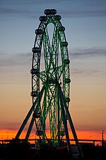
Docklands (also known as Melbourne Docklands to differentiate it from London Docklands) is an inner suburb of Melbourne, Victoria, Australia, 2 km (1.2 mi) west of the city's Central Business District (CBD). Its local government area is the City of Melbourne. At the 2016 Census, Docklands had a population of 10,964. Primarily a waterfront area centred on the banks of the Yarra River, it is bounded by Wurundjeri Way and the Charles Grimes Bridge to the east, CityLink to the west and Lorimer Street across the Yarra to the south. The site of modern-day Docklands was originally swamp land that in the 1880s became a bustling dock area as part of the Port of Melbourne, with an extensive network of wharfs, heavy rail infrastructure and light industry. Following the containerisation of shipping traffic, Docklands fell into disuse and by the 1990s was virtually abandoned, making it the focal point of Melbourne's underground rave scene. The construction of Docklands Stadium in the late 1990s attracted developer interest in the area, and urban renewal began in earnest in 2000 with several independent privately developed areas overseen by VicUrban, an agency of the Victorian Government. Docklands subsequently experienced an apartment boom and became a sought-after business address, attracting the national headquarters of, among others, the National Australia Bank, ANZ, Medibank and the Bureau of Meteorology, as well as the regional headquarters for Ericsson and Bendigo Bank.Known for its striking contemporary architecture, the suburb is home to a number of heritage buildings that have been retained for adaptive reuse, and is also the site of landmarks such as the aforementioned Docklands Stadium, Southern Cross Station and the Melbourne Star Observation wheel. Although still incomplete, Docklands' developer-centric planning has split public opinion with some lamenting its lack of green open space, pedestrian activity, transport links and culture.