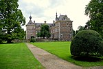
Fortified position of Liège

The fortified position of Liège (French: position fortifiée de Liège [PFL]) was established after the First World War by Belgium to block the traditional invasion corridor through Belgium between Germany and France. In the First World War the Belgian Army held up the Germans for a week at Liège, delaying the German invasion of France, caused Belgium to consider a similar defensive strategy. Belgium rebuilt the Liège fortifications and extended them onto the Pays de Herve (Herve plateau) closer to Germany, using the most advanced fortification technology available. The PFL was divided into the modern defensive line, anchored on the Albert Canal by Fort Eben-Emael and extending to the south through a planned five additional forts, designated PFL I and the ring of forts around Liège. Liège commanded crucial road and rail crossings of the Meuse and was as strategically important in the 1930s as in 1914. The modernized Liège forts were called PFL II. In 1936, Belgium's neutrality was proclaimed again by King Leopold III of Belgium in a vain attempt to forestall another invasion, preventing France from being able to make use of the Belgian defences and territory in the forward defence of France. At the outbreak of the Second World War, Belgian defences had to resist alone until France could advance into Belgium after its neutrality had been violated. Again the fortifications could not hold the Germans.
Excerpt from the Wikipedia article Fortified position of Liège (License: CC BY-SA 3.0, Authors, Images).Fortified position of Liège
Tunnel entre Lanaye et Eben-Emael,
Geographical coordinates (GPS) Address Website Nearby Places Show on map
Geographical coordinates (GPS)
| Latitude | Longitude |
|---|---|
| N 50.796944444444 ° | E 5.6811111111111 ° |
Address
Fort d'Eben Emael
Tunnel entre Lanaye et Eben-Emael
Liège, Belgium
Open on Google Maps


