Tullibody Inch
Islands of the ForthLandforms of ClackmannanshireRiver islands of Scotland

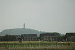
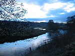
Tullibody Inch is an islet in the estuarine waters of the River Forth. It takes its name from the nearby town of Tullibody, "inch" being from the Scottish Gaelic innis meaning "island" or "meadow".The island used to be farmland but has become flooded due to mining subsidence. It is now part of the Firth of Forth SSSI, which also includes nearby Alloa Inch and the John Muir Country Park. The Scottish Wildlife Trust owns and manages the island as a nature reserve.
Excerpt from the Wikipedia article Tullibody Inch (License: CC BY-SA 3.0, Authors, Images).Tullibody Inch
The Pavilions,
Geographical coordinates (GPS) Address External links Nearby Places Show on map
Geographical coordinates (GPS)
| Latitude | Longitude |
|---|---|
| N 56.11121 ° | E -3.83015 ° |
Address
Tullibody Inch
The Pavilions
FK10 1TA
Scotland, United Kingdom
Open on Google Maps


