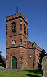
Bearwood, West Midlands

Bearwood is the southern part of Smethwick, Sandwell, West Midlands, England, and north of the A456 Hagley Road. Bearwood Hill was the original name of the High Street from Smethwick Council House to Windmill Lane. The border at the Shireland Brook where Portland Road (Edgbaston) becomes Shireland Road (Sandwell) is signed "Bearwood" (February 2014). The part of Bearwood to the west of Shireland Brook is included in Abbey Ward in Sandwell Metropolitan Borough. The smaller part of Bearwood to the east of Shireland Brook is in the North West Edgbaston ward in Birmingham. In 1903, Bearwood Ward in Smethwick extended from Hagley Road to Smethwick High Street and included part of Cape Hill.The Bearwood telephone exchange area marked out by the 0121-429, 420, and 434 numbers extends as far east as Harborne Walkway. Bearwood, like many areas of the West Midlands conurbation, has a local sense of place, although it has become absorbed into Smethwick. Many locals still use the term "The Bear" especially referring to "The Bear Hotel" located in Bearwood. An old map of the 18th century mentions 'The Bear of Smethwick'.
Excerpt from the Wikipedia article Bearwood, West Midlands (License: CC BY-SA 3.0, Authors, Images).Bearwood, West Midlands
Bearwood Road, Sandwell
Geographical coordinates (GPS) Address Nearby Places Show on map
Geographical coordinates (GPS)
| Latitude | Longitude |
|---|---|
| N 52.476 ° | E -1.969 ° |
Address
The Co-operative Food
Bearwood Road 513-519
B66 4BE Sandwell
England, United Kingdom
Open on Google Maps


