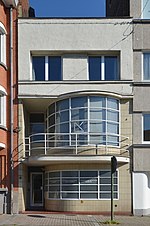
Pays Noir
Areas of BelgiumCoal mining regions in BelgiumGeography of CharleroiGeography of Hainaut (province)Regions of Wallonia
The Pays Noir (French for 'black country') refers to a region of Belgium, centered on Charleroi in the province of Hainaut in Wallonia so named for the geological presence of coal. In the 19th century the region rapidly industrialised first with coal mines, then with related industries such as steel manufacture and glass production.
Excerpt from the Wikipedia article Pays Noir (License: CC BY-SA 3.0, Authors).Pays Noir
Rue de la Marine (Nord) - Rue du Château d'Eau (Sud), Charleroi
Geographical coordinates (GPS) Address Nearby Places Show on map
Geographical coordinates (GPS)
| Latitude | Longitude |
|---|---|
| N 50.431 ° | E 4.433 ° |
Address
Rue de la Marine (Nord) - Rue du Château d'Eau (Sud) 119
6042 Charleroi (Lodelinsart)
Hainaut, Belgium
Open on Google Maps


