place

National Oceanography Centre

2010 establishments in EnglandNatural Environment Research CouncilOceanographic organizationsOrganisations based in SouthamptonResearch institutes established in 2010
Research institutes in HampshireUniversity of Southampton

The National Oceanography Centre (NOC) is a marine science research and technology institution based on two sites in Southampton and Liverpool, United Kingdom. It is the UK’s largest institution for integrated sea level science, coastal and deep ocean research and technology development.From 1 November 2019 the NOC began operating as an independent self-governing organisation – a charitable company limited by guarantee. The centre was set up to work in close partnership with institutions across the UK marine science community to address key science challenges, including sea level change, the oceans’ role in climate change, predicting and simulating the behaviour of the oceans through computer modelling, the future of the Arctic Ocean and long-term monitoring technologies.

Excerpt from the Wikipedia article National Oceanography Centre (License: CC BY-SA 3.0, Authors).

National Oceanography Centre
Tasman Close, Southampton Ocean Village

Geographical coordinates (GPS) Address Nearby Places
placeShow on map

Wikipedia: National Oceanography CentreContinue reading on Wikipedia

Geographical coordinates (GPS)

Latitude Longitude
N 50.89286 ° E -1.39481 °
placeShow on map

Address

Waterfront Campus

Tasman Close
SO14 3TP Southampton, Ocean Village
England, United Kingdom
mapOpen on Google Maps

Share experience

Nearby Places

Port of Southampton
Port of Southampton

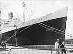
The Port of Southampton is a passenger and cargo port in the central part of the south coast of England. The modern era in the history of the Port of Southampton began when the first dock was inaugurated in 1843. The port has been owned and operated by Associated British Ports since 1982, and is the busiest cruise terminal and second largest container port in the UK. The volume of port traffic categorises Southampton as a Medium-Port City globally.The port is ten miles (16 km) inland, between the confluence of the rivers Test and Itchen and the head of the mile-wide drowned valley known as Southampton Water. The mouth of the inlet is protected from the effects of foul weather by the mass of the Isle of Wight, which gives the port a sheltered location. Additional advantages include a densely populated hinterland and close proximity to London, and excellent rail and road links to the rest of Britain which bypass the congestion of London. The average tidal range is approximately 5 feet (1.5 metres), with 17 hours per day of rising water thanks to the port's "double tides". These allow the largest container and cruise ships access to the port for up to 80 per cent of the time, according to the container terminal operator DP World Southampton. The effect is a result of tidal flow through the English Channel: high tide at one end of the Channel (Dover) occurs at the same time as low tide at the other end (Land's End). Points near the centre have one high water as the tidal swell goes from left to right, another as it then goes from right to left. Neither is as high as the one at each end.The principal berths are divided into three areas, The Old Dock at the junction of the Rivers Test and Itchen consisting of berths 20–49; The New Dock, known as the Western Dock, built by the Southern Railway consisting of Berths 101–110; and the Container Terminal consisting of berths 201–207. The container terminal was constructed entirely on reclaimed land, with berth 201 opening in 1968. The berths at the container terminal have since been renamed. Berths 207 to 204 are now berths SCT 1 to 4 respectively and the reconstructed berths 201/202 now SCT 5.