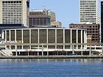
Fort Detroit

Fort Pontchartrain du Détroit or Fort Detroit (1701–1796) was a fort established on the north bank of the Detroit River by the French officer Antoine de la Mothe Cadillac and the Italian Alphonse de Tonty in 1701. In the 18th century, French colonial settlements developed on both sides of the river, based on the fur trade, missions, and farms. The site of the former fort, north of the Rouge River, is now within the city of Detroit in the U.S. state of Michigan, an area bounded by Larned Street, Griswold Street, Washington Blvd. and the Civic Center (now occupied by office towers). The fort was taken over by the British after the French surrendered Montreal in 1760 during the French and Indian War (part of the Seven Years' War). The British held it until the American Revolutionary War, and it was taken over by the United States afterward. The British built Fort Lernoult to the north along the river in 1779. This was later renamed Fort Shelby and was abandoned by the US military in the 1820s. The city of Detroit demolished Fort Shelby in 1827.
Excerpt from the Wikipedia article Fort Detroit (License: CC BY-SA 3.0, Authors, Images).Fort Detroit
Washington Boulevard, Detroit
Geographical coordinates (GPS) Address Phone number Nearby Places Show on map
Geographical coordinates (GPS)
| Latitude | Longitude |
|---|---|
| N 42.328055555556 ° | E -83.047777777778 ° |
Address
Crowne Plaza Detroit Downtown Riverfront
Washington Boulevard 2
48226 Detroit
Michigan, United States
Open on Google Maps


