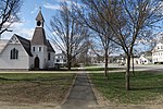
Fort at Number 4
1740 establishments in the Thirteen Colonies1960 establishments in New HampshireBritish forts in the United StatesCharlestown, New HampshireColonial forts in New Hampshire ... and 5 more
Forts in New HampshireFrench and Indian War fortsLiving museums in New HampshireMilitary and war museums in New HampshireMuseums in Sullivan County, New Hampshire

The Fort at Number 4 was a mid-18th century stockade fortification protecting Plantation Number 4, the northernmost British settlement along the Connecticut River in the Province of New Hampshire until after the French and Indian War. It was located in the present-day town of Charlestown, New Hampshire. A recreation of the fort, dating to 1960, now functions as an open-air museum, and was added to the New Hampshire State Register of Historic Places in July 2020.
Excerpt from the Wikipedia article Fort at Number 4 (License: CC BY-SA 3.0, Authors, Images).Fort at Number 4
Patch Park,
Geographical coordinates (GPS) Address Nearby Places Show on map
Geographical coordinates (GPS)
| Latitude | Longitude |
|---|---|
| N 43.255 ° | E -72.432222222222 ° |
Address
Patch Park
Patch Park
03603
New Hampshire, United States
Open on Google Maps


