Rancho Temescal (Serrano)

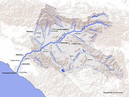
Rancho Temescal was a farming outpost of Mission San Luis Rey de Francia, one of the 21 Franciscan missions established in California by Spain during the late 18th and early 19th centuries. The Mission was located on the coast where Oceanside, California is today. The Rancho was settled in 1819 by Leandro Serrano, and became the first non-native settlement within the boundaries of what would become Riverside County, California. Although Serrano applied for a land grant with Governor José María de Echeandía, during the Mexican administration of California, a grant was never issued. The only supporting evidence of his claim was a paper from the San Luis Rey Mission permitting him to occupy the land for grazing. After Serrano's death in 1852, his wife, Josefa Montalva de Serrano, continued to pursue the claim, now under the administration of the United States, but the claim was ultimately rejected by the US Supreme Court in 1866.The grant claim extended along the Temescal Valley south of present-day Corona and encompassed El Cerrito and Lee Lake. At the time, Rancho Temescal was a part of San Bernardino County. Riverside County was created by the California Legislature in 1893 by taking land from both San Bernardino and San Diego County.
Excerpt from the Wikipedia article Rancho Temescal (Serrano) (License: CC BY-SA 3.0, Authors, Images).Rancho Temescal (Serrano)
Lookout Lane,
Geographical coordinates (GPS) Address Nearby Places Show on map
Geographical coordinates (GPS)
| Latitude | Longitude |
|---|---|
| N 33.76912 ° | E -117.4902 ° |
Address
Lookout Lane
92883
California, United States
Open on Google Maps


