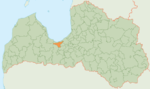
Buļļi

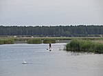
Buļļi or Rītabuļļi is a neighbourhood of Riga, the capital of Latvia. The Western area is known as Vakarbuļļi. The boundaries of the Buļļi neighborhood are the Riga city border, the Gulf of Riga, the trail leading to the Gulf of Riga, Dzintara Street, an imaginary parallel line to Roņu Street, Buļļupe. The Buļļi neighborhood is located in the extreme Northwest corner of Riga on Buļļi Island. It borders the Daugavgrīva and Kleisti neighborhoods, as well as Jūrmala city, although by land the only connection to this neighborhood is with Daugavgrīva. Administratively, this neighborhood is located in the Kurzeme District, Riga. The area of the neighborhood is 7,497 square kilometres (2,895 sq mi). Buļļi contains the Vakarbuļļi swimming location, which is an important recreational spot for Riga residents and in 2009 was the only swimming location in the territory of Riga, which has been awarded the Blue Flag beach designation.
Excerpt from the Wikipedia article Buļļi (License: CC BY-SA 3.0, Authors, Images).Buļļi
Riga Vakarbuļļi
Geographical coordinates (GPS) Address Website Nearby Places Show on map
 Continue reading on Wikipedia
 Geographical coordinates (GPS)
| Latitude | Longitude |
|---|---|
| N 57.012222222222 ° | E 23.956666666667 ° |
Address
dabas parks „Piejūra”
Riga, Vakarbuļļi
Vidzeme, Latvia
Open on Google Maps
Website
daba.gov.lv