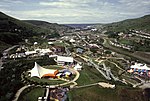
Cwm, Blaenau Gwent
Communities in Blaenau GwentVillages in Blaenau GwentWards of Blaenau Gwent

Cwm (from Welsh: Y Cwm, transl. The Valley) is a former coal mining village, community and electoral ward three miles (4.8 km) south of Ebbw Vale in the county borough of Blaenau Gwent, Wales, within the historic boundaries of Monmouthshire, United Kingdom. In the far north of the community lies Waunlwyd.
Excerpt from the Wikipedia article Cwm, Blaenau Gwent (License: CC BY-SA 3.0, Authors, Images).Cwm, Blaenau Gwent
A4046,
Geographical coordinates (GPS) Address Nearby Places Show on map
Geographical coordinates (GPS)
| Latitude | Longitude |
|---|---|
| N 51.7409 ° | E -3.1812 ° |
Address
A4046
NP23 7RA , Victoria
Wales, United Kingdom
Open on Google Maps


