place

Bayside Cemetery (Queens)

1865 establishments in New York (state)Cemeteries established in the 1860sCemeteries in Queens, New YorkCemetery vandalism and desecrationJewish cemeteries in New York City
Jews and Judaism in Queens, New YorkOzone Park, QueensUse mdy dates from January 2021

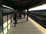
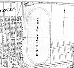
Bayside Cemetery is a Jewish cemetery at 80-35 Pitkin Avenue in Ozone Park, Queens, New York City. It covers about 12 acres (4.9 ha) and has about 35,000 interments. It is bordered on the east by Acacia Cemetery, on the north by Liberty Avenue, on the west by Mokom Sholom Cemetery, and on the south by Pitkin Avenue. Bayside was established by Congregation Shaare Zedek when the latter was an Orthodox Jewish synagogue on the Lower East Side of Manhattan. Shaare Zedek still owns Bayside Cemetery and is currently a Conservative synagogue on Manhattan's Upper West Side, about 10 miles (16 km) away. The cemetery is reachable via the New York City Subway's IND Fulton Street Line (A train) to the 80th Street or 88th Street stations.

Excerpt from the Wikipedia article Bayside Cemetery (Queens) (License: CC BY-SA 3.0, Authors).

Bayside Cemetery (Queens)
Pitkin Avenue, New York Brooklyn

Geographical coordinates (GPS) Address Nearby Places
placeShow on map

Wikipedia: Bayside Cemetery (Queens)Continue reading on Wikipedia

Geographical coordinates (GPS)

Latitude Longitude
N 40.6775 ° E -73.855 °
placeShow on map

Address

Pitkin Avenue & 80th Street

Pitkin Avenue
11416 New York, Brooklyn
New York, United States
mapOpen on Google Maps

Share experience

Nearby Places

The Hole, New York City

The Hole is a small neighborhood in New York City on the border between Brooklyn and Queens. It is a low-lying area, with a ground level that is 30 feet (9.1 m) lower than the surrounding area. The area is run-down, and suffers from frequent flooding. It has been described as a "lost neighborhood," and as resembling a border town from the Wild West. It is generally bordered by Eldert Lane, 78th (Sapphire) Street, South Conduit Avenue, and Linden Boulevard. Nearby neighborhoods include East New York, Lindenwood, and Ozone Park. The Hole is home to the New York City Federation of Black Cowboys.In the 1960s, the level of some streets within The Hole were raised and the streets paved, facilitating passage between South Conduit Avenue and Linden Boulevard. This required homes adjacent to the raised streets to build retaining walls with the first level of their houses now below grade. In 2004, the Department of Environmental Protection (DEP) made plans to connect the neighborhood to the city's sewer system to combat the flooding by raising the land.In 2010, filmmakers Courtney Fathom Sell and Billy Feldman made a short documentary about the neighborhood. The film includes interviews with some of the residents as well as members of the Federation of Black Cowboys. The film premiered at Rooftop Films in 2011 and has since been archived at the Brooklyn Historical Society & Anthology Film Archives. Another film, focused on the residents living in the Hole, was made in 2016.The Hole is the site of an old Mafia graveyard, located in a vacant lot off of 78th (Sapphire) Street between Blake and Dumont Avenues. In 1981, children playing in the lot found the body of Bonanno crime family capo Alphonse "Al" Indelicato, who, along with fellow Bonanno capos Philip "Philly Lucky" Giaccone and Dominick "Big Trin" Trinchera, had been killed several weeks before in a Brooklyn night club store room by rival Bonanno capo Joseph Massino and his associates. In 2004, the bodies of Giaccone and Trinchera were dug up in the lot by FBI agents and New York City police detectives. The bodies were disposed of in the lot as a favor by the crew of John Gotti, who had grown up with Massino. Although not all of their bodies have been found, as many as six Mafia murder victims are believed by authorities to have been buried in the lot in the late 1970s and early 1980s. These include John Favara, a Queens furniture store manager killed because he accidentally ran over the 12-year-old son of John Gotti, and Lucchese crime family members Joseph Spione and Thomas DeSimone, on whom Joe Pesci's character Tommy DeVito in Goodfellas was based.
Lynch Triangle

Reverend Lawrence E. Lynch Memorial Triangle is a 0.138 acres (0.056 hectares) park located at the intersection of Rockaway Boulevard, Atlantic Avenue, and 81st Street in Ozone Park, Queens, New York City. The neighborhood's streets were laid out in a grid of streets and avenues at the turn of the 20th century while Rockaway Boulevard cuts diagonally through the grid on its route between Cypress Hills and Woodmere. Triangular intersections that were too small to be developed were designated as public plazas, including this one. In 1949, the city designated this triangle in memory of Lynch, a Woodhaven resident who served as a chaplain in the Pacific Theater during World War Two. Lawrence Lynch was born in Brooklyn in 1917, one of twelve children of devout Catholic parents who emigrated from Ireland. He served as an altar boy at the St. Sylvester church and was ordained as a priest in 1932 through the Redemptorist Order.During World War Two he was assigned as chaplain the legendary Fighting 69th Infantry of the National Guard, where he earned the nickname Father Cyclone for his tireless efforts to comfort the injured and ill of all faiths. He was killed at age 38 on April 25, 1945, during the Battle of Okinawa, while administering Last Rites to a dying soldier. Lynch was buried at the Redemptorist Cemetery, Mount Saint Alphonsus, in Esopus, New York. Although the triangle was named for Lynch in 1949, the sign carrying the name disappeared and the honor was forgotten for more than a half century.In 2018, Ed Wendell, President of Woodhaven Cultural and Historical Society, approached Councilman Eric Ulrich to have the triangle rededicated for Lynch. On March 10, 2019 the triangle was officially named for Lynch with a ceremony that commemorated his actions during the war.