Culgaith
Civil parishes in CumbriaCulgaithEden DistrictUse British English from December 2014Villages in Cumbria

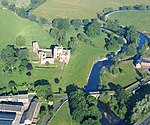
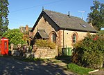
Culgaith is a village and civil parish in the Westmorland and Furness district of Cumbria, north west England. The village is on a ridge above the River Eden, between Temple Sowerby and Langwathby. At the 2001 census the parish had a population of 721, increasing to 826 at the 2011 Census.Amenities include All Saints Church, and its associated primary school, as well as a public house. The village railway station closed in 1970.
Excerpt from the Wikipedia article Culgaith (License: CC BY-SA 3.0, Authors, Images).Culgaith
B6412,
Geographical coordinates (GPS) Address Nearby Places Show on map
Geographical coordinates (GPS)
| Latitude | Longitude |
|---|---|
| N 54.661 ° | E -2.605 ° |
Address
B6412
CA10 1QG , Culgaith
England, United Kingdom
Open on Google Maps


