place

Blencarn

Cumbria geography stubsEden DistrictUse British English from September 2019Villages in CumbriaWikipedia spam cleanup from February 2013
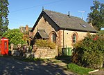
The village green, Blencarn, Culgaith CP geograph.org.uk 286850

Blencarn is a small village located in the Eden District of Cumbria, England. The village is situated at the foot of the Pennines. In Blencarn there is fly fishing at the 15-acre (61,000 m2) Blencarn lake.

Excerpt from the Wikipedia article Blencarn (License: CC BY-SA 3.0, Authors, Images).

Geographical coordinates (GPS)

Latitude Longitude
N 54.675 ° E -2.562 °
placeShow on map

Address

Kirkhill
CA10 1TZ , Culgaith
England, United Kingdom
mapOpen on Google Maps

The village green, Blencarn, Culgaith CP geograph.org.uk 286850
Share experience

Nearby Places

Milburn, Cumbria
Milburn, Cumbria

Milburn is a small village and civil parish in the Eden district of Cumbria, England. It is located on the northern side of the Eden Valley, about 9 miles (14.5 km) east of Penrith. The parish had a population of 171 in both the 2001, and 2011 censuses.It lies beneath Cross Fell, the highest point of the Pennines and is one of a chain of villages following the 200 metres (660 ft) contour of the escarpment. The fellside forms part of the North Pennines Area of Natural Beauty which in 2003 was awarded the status of UNESCO European Geopark and includes the Moorhouse Upper Teesdale National Nature Reserve. The parish includes the outlying hamlets of Gullom Holme and Milburn Grange, respectively 0.5 miles (0.8 km) and 1.25 miles (2.0 km) from Milburn village centre. The core village consists of a tight cluster of houses, many dating from the mid-18th century, ranged around a roughly rectangular green. A medieval church and a fortified manor house lie outside the main village area. In 2006 the total population of the parish was approximately 170, representing a total of 74 households. Agriculture still provided the single most significant source of employment and this accounted for approximately 25% of the employment of the working population. A number of businesses offering professional and construction services now operate in the village, and local non-agricultural work accounted for the employment of a further 20%. The remaining 55% commuted out of the village to their employment. Of the total population, 30% were retired. The village retains its primary school though the majority of the pupils now come from outside the parish.

Maiden Way
Maiden Way

The Maiden Way or Maidenway (Middle English: Maydengathe; Medieval Latin: Via Puellarum) was a roughly 20-mile (32 km) Roman road in northern Britain connecting the Roman fort of Bravoniacum (Kirkby Thore) near Penrith with that of Magnis (Carvoran) on Hadrian's Wall, via the intermediate fort of Epiacum (also known as Whitley Castle) roughly half-way between the two. William Bainbridge wrote an early paper on the road, in Archaeologia Aeliana; Account of the Roman Road, called the Maiden Way (1851).In 2016, it was reported that investigations using LIDAR technology by the Environment agency for the purposes of flood mapping and other environmental management were providing extensive data showing the existence of underground archaeological features including Roman roads. This included a continuation of the Maiden Way southwards from Kirkby Thore to the Roman fort at Low Borrowbridge near Tebay.Bravoniacum was a waypoint on the northern leg of the Roman road connecting Luguvalium (Carlisle) with Eboracum (York) and points south. Magnis was one of the waypoints on the Stanegate beside Hadrian's Wall. As such, the Maiden Way served as a shortcut for supplying the central and eastern areas of the Wall. It also provided supplies to the lead and silver mines near Epiacum (Whitley Castle).The Maiden Way was sometimes considered also to have run east along the Stanegate to Banna (Birdoswald), then 7 miles (11 km) north to Bewcastle Roman Fort, and thence to Liddesdale, but the zig-zag identity of this course as a single road is problematic.Following the end of Roman rule in Britain, the Maiden Way was used as a drovers' road. The route was probably named after the Maiden Castle fortlet guarding the Stainmore Pass to the east of the fort of Verterae (Brough).The Pennine Way footpath follows the line of the Maiden Way for several miles on a roughly north-south route across Lambley Common in Northumberland, above the west bank of the river South Tyne. Immediately north of this stretch, a modern minor road follows the line of the Maiden Way for several miles to the west of Featherstone Castle.