Battert

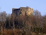
The Battert is a hill, 567.9 m above sea level (NHN), on the western edge of the Northern Black Forest north of Baden-Baden in Germany. On its western slopes are the ruins of Hohenbaden Castle (the Altes Schloss or "Old Castle"), on the southern side is the climbing area and nature reserve called the Battert Rocks (Battertfelsen). On the hill ridge are the remains of a circular rampart, probably built by Celtic settlers. On the eastern side lies the village of Ebersteinburg. The Battert is a destination for ramblers and climbers all year round, heading for the 15–60-metre-high Battertfelsen. Above and below the rock face is a footpath around the rocks. The red rock face is visible from far off and may be easily reached on the road to the ruins of Hohenbaden or from a car park near Ebersteinburg.
Excerpt from the Wikipedia article Battert (License: CC BY-SA 3.0, Authors, Images).Battert
Oberer Battertweg,
Geographical coordinates (GPS) Address Nearby Places Show on map
Geographical coordinates (GPS)
| Latitude | Longitude |
|---|---|
| N 48.778888888889 ° | E 8.2533333333333 ° |
Address
Oberer Battertweg
Oberer Battertweg
76530
Baden-Württemberg, Germany
Open on Google Maps


