Hoofddorppleinbuurt
Neighbourhoods of AmsterdamNorth Holland geography stubs

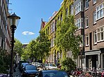
Hoofddorppleinbuurt is a neighborhood of Amsterdam, Netherlands, part of the borough of Amsterdam-Zuid. The district had 10,771 inhabitants as of 1 January 2005. The total area is 96.71 hectares. Hoofddorppleinbuurt was built in the 1920s. Since 1927 the neighborhood through the Zeilbrug has been connected to Amstelveenseweg. It is a mostly a residential neighborhood, but there are a few companies and other institutions.
Excerpt from the Wikipedia article Hoofddorppleinbuurt (License: CC BY-SA 3.0, Authors, Images).Hoofddorppleinbuurt
Hoofddorpplein, Amsterdam
Geographical coordinates (GPS) Address Nearby Places Show on map
Geographical coordinates (GPS)
| Latitude | Longitude |
|---|---|
| N 52.351111111111 ° | E 4.8497222222222 ° |
Address
Hoofddorpplein
Hoofddorpplein
1059 CW Amsterdam
North Holland, Netherlands
Open on Google Maps


