Hallrule
Scottish Borders geography stubsVillages in the Scottish Borders

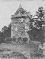
Hallrule is a hamlet on the B6357 road, in the Scottish Borders area of Scotland, on the Rule Water, near Abbotrule, Bedrule Bonchester Bridge, Denholm, Hobkirk, Ruletownhead and to the south, the Wauchope Forest. The village's name in 1502 was Hawroull, and Hallrule Tower was held by George Turnbull. It was burned in 1523 and in 1544.
Excerpt from the Wikipedia article Hallrule (License: CC BY-SA 3.0, Authors, Images).Hallrule
B6357,
Geographical coordinates (GPS) Address Nearby Places Show on map
Geographical coordinates (GPS)
| Latitude | Longitude |
|---|---|
| N 55.4183 ° | E -2.64427 ° |
Address
B6357
TD9 8JB
Scotland, United Kingdom
Open on Google Maps


