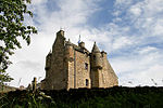
Abbotrule
Villages in the Scottish Borders

Abbotrule is a hamlet south of the B6357 road, in the Scottish Borders area of Scotland, on Rule Burn, east of the Rule Water. Places nearby include Bedrule, Hallrule, Spittal-on-Rule, Ruletownhead, Bonchester Bridge, Denholm, Southdean, Hobkirk, Ferniehirst Castle and the Wauchope Forest. Abbotrule was the property of the church from the 12th-Century to 1560, and thereafter a country estate successively owned by Kerrs, Hendersons and Cunninghams. By 1956, the estate seat, Abbotrule House, had been demolished. Abbotrule was a parish until 1777, when it was divided between two other parishes; the parish church at Abbotrule was deroofed sometime shortly thereafter.
Excerpt from the Wikipedia article Abbotrule (License: CC BY-SA 3.0, Authors, Images).Abbotrule
Geographical coordinates (GPS) Address Nearby Places Show on map
Geographical coordinates (GPS)
| Latitude | Longitude |
|---|---|
| N 55.40827 ° | E -2.617424 ° |
Address
TD9 8JE
Scotland, United Kingdom
Open on Google Maps


