place

Webb Mountain Discovery Zone

Education in Fairfield County, ConnecticutMonroe, ConnecticutNature centers in ConnecticutParks in Fairfield County, Connecticut
Webb Mountain Park I

The Webb Mountain Discovery Zone is a 170 acre park and outdoor learning center in Monroe, Connecticut, United States. The adjacent 135 acre Webb Mountain Park connects up to a 13.5 mile trail network. The park covers 170 acres (0.69 km2) and has 3 loop trails, each with marked interpretive signs. There is also an outdoor classroom for schools and groups, and a scavenger hunt scorecard. There are no other visitor facilities. The park provides additional educational resources for teachers, as well as programs for school groups, daycare centers, and scouts. The park is owned by the Town of Monroe and administered by the Friends of Webb Mountain. The park is currently under the direction of Tom Ellbogen.

Excerpt from the Wikipedia article Webb Mountain Discovery Zone (License: CC BY-SA 3.0, Authors, Images).

Webb Mountain Discovery Zone
Webb Circle,

Geographical coordinates (GPS) Address Nearby Places
placeShow on map

Wikipedia: Webb Mountain Discovery ZoneContinue reading on Wikipedia

Geographical coordinates (GPS)

Latitude Longitude
N 41.3605 ° E -73.1705 °
placeShow on map

Address

Webb Circle 39
06468
United States
mapOpen on Google Maps

Webb Mountain Park I
Share experience

Nearby Places

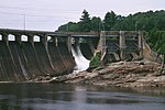
Stevenson Dam Hydroelectric Plant

The Stevenson Dam Hydroelectric Plant is a hydroelectric power plant located on the Housatonic River at the boundary between the towns of Monroe and Oxford, Connecticut. The Connecticut Light and Power Company began construction in 1917 (completed 1919) and FirstLight Power has since gained ownership. It was listed on the National Register of Historic Places in 2000 and is considered to have high hazard potential by the National Inventory of Dams. The site includes three contributing structures: the Stevenson Dam, the Stevenson Dam Bridge, and the Stevenson Powerhouse.The Stevenson Dam Bridge, a reinforced concrete bridge that is integral with the dam, carries Route 34 across the river, making it unique among period dams in the eastern United States. The Stevenson Powerhouse is a 160 ft by 80 ft building rising 131 ft in height. Its exterior includes "massive" pilasters. The hydroelectric plant began producing electricity in 1919 with 3 turbine/generator units, for a total of 19 MW. A fourth unit of 12 MW was added in 1936 and, with improvements over the years, the plant now produces a total of 28.9 MW of power. Bedrock characteristics required the powerhouse to be built on the Monroe side of the dam and it remains Monroe's biggest single-site taxpayer. The plant was covered in a Historic American Engineering Record (HAER) study, record CT-183. Completion of the dam impounded the Housatonic River and created what came to be Lake Zoar, a lake with 27 miles of shoreline, and covering an area named "Pleasantvale" or "Pleasant Vale", which had been part of Oxford and Stevenson.The Stevenson plant was developed by the Rocky River Power Company, founded in 1905 by J. Henry Roraback to produce hydroelectric power on a tributary of the Housatonic, with operating rights expanding to the entire Housatonic watershed in 1909. Roraback's company was a predecessor to the Connecticut Light and Power Company, now part of Eversource. The dam was the first high dam on the river. The project was designed by Birkinbine Engineering Office, Charles T. Main Associates of Boston, Massachusetts, and J.A.P Crisfield Co., and was built by C. W. Blakeslee Co., a local contractor.A work camp, Camp Crisfield, was developed around the 800 men employed to work the site day and night, including a church, carpentry shops, and hospital.An urban legend exists that asserts a worker fell into the cement as it was being poured and was never heard from again. This originates from a worker who signed in one day, and then never signed off.
White Hills (Shelton)

White Hills is a section of the city of Shelton, Connecticut. It is one of the oldest parts of the city, with historical buildings dating to the early 18th century. It is the most rural part of Shelton, though much of it is now suburban. White Hills got its name for the higher altitude it has compared with the rest of Shelton. The rolling hills in the area were named White for several reasons: The snow melted slower in the spring, the visible lyme rock, and the wild dogwood blossoms. White Hills is bordered by Monroe to the north and west, the Housatonic River to the east, the "downtown" to the southeast, and Huntington to the southwest. Its road borders are roughly East Village Road to the east and north, Beardsley Road to the north, and Route 110 (Leavenworth and Shelton Roads) to the west and south. However, Maple Avenue (to the southwest) is considered part of Lower White Hills, but claimed by both Huntington and White Hills. The Lower White Hills Cemetery (1700) is on Maple Avenue, just west of Route 110. White Hills has a volunteer fire department, Shelton Fire Company 5. The fire company was formed in 1947 and the first truck was purchased in 1948, costing $7,000. Members signed personal notes to assure the payment of the new vehicle. They also held two-day country fairs to help in the payment for the new fire truck. Those two-day fairs were a tremendous amount of work. Some of the attractions were, animals and produce on exhibit, there was a baked goods table, white elephant table, snack bar, games of chance, raffles, square dancing, and many other attractions. The department has frequently won honors at local marching parades. White Hills has both a rural character and access to nearby shopping areas. The section of town is equidistant from Monroe center, Huntington center, and downtown Shelton. There is a recreational facility in the area called East Village Park, established in the early 1980s. Landmarks: Lincoln Spruce French's Corner