Frankfurter Allee
Berlin geography stubsBuildings and structures in Friedrichshain-KreuzbergGermany road stubsStreets in Berlin

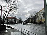
The Frankfurter Allee is one of the oldest roads of Berlin, the capital city of Germany. It extends the Karl-Marx-Allee from Frankfurter Tor in the direction of the city of Frankfurt (Oder). It is part of Bundesstraße 1 and has a length of 3.6 kilometres (2.2 mi). Line of the city's U-Bahn runs beneath the length of Frankfurter Allee. The U-Bahn stations of Frankfurter Tor, Samariterstraße, Frankfurter Allee, Magdalenenstraße and Lichtenberg are all under or adjacent to the street. Frankfurter Allee and Lichtenberg stations are also served by the city's S-Bahn.
Excerpt from the Wikipedia article Frankfurter Allee (License: CC BY-SA 3.0, Authors, Images).Frankfurter Allee
Frankfurter Allee, Berlin Lichtenberg
Geographical coordinates (GPS) Address Nearby Places Show on map
Geographical coordinates (GPS)
| Latitude | Longitude |
|---|---|
| N 52.513055555556 ° | E 13.478888888889 ° |
Address
S+U Frankfurter Allee
Frankfurter Allee
10365 Berlin, Lichtenberg
Germany
Open on Google Maps


