place

Conicville, Virginia

Census-designated places in Shenandoah County, VirginiaCensus-designated places in VirginiaPages with non-numeric formatnum argumentsShenandoah Valley, Virginia geography stubsUse mdy dates from July 2023

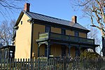
Conicville is a census-designated place in Shenandoah County, in the U.S. state of Virginia, at the intersection of State Route 42 - Senedo Road (also referred to Back Road in earlier times and Censuses) and County Road 703 - Conicville Road. Conicville was formerly known as Cabin Hill, as it was a cluster of approximately 22 homes, Christ Church and several, now closed, businesses, and is located at the northeast end of the Cabin Hill ridge that runs parallel to and just east of Swover Creek and State Route 42, from Hudson Crossroads, at SR 42 and CR 720 - Crooked Run Road. The US Geological Survey notes a Bench Mark elevation of 1256 feet, just south of the SR 42 / CR 703 intersection. Latitude 38.83 and longitude -78.69. Conicville/Cabin Hill was founded by European, primarily Swiss (Mennonites) and Germanic immigrants, who emigrated through Pennsylvania, in the mid-1700s, to what was then Frederick County of Virginia. As population grew, Dunmore County was formed from part of Frederick County and was later renamed Shenandoah County.

Excerpt from the Wikipedia article Conicville, Virginia (License: CC BY-SA 3.0, Authors).

Conicville, Virginia
Senedo Road,

Geographical coordinates (GPS) Address Nearby Places
placeShow on map

Wikipedia: Conicville, VirginiaContinue reading on Wikipedia

Geographical coordinates (GPS)

Latitude Longitude
N 38.83 ° E -78.69 °
placeShow on map

Address

Senedo Road 14327
22842
Virginia, United States
mapOpen on Google Maps

Share experience

Nearby Places

Mount Clifton, Virginia

Mount Clifton is a census-designated place in Shenandoah County, in the U.S. state of Virginia. As of the 2020 decennial census the village was noted as having 110 residents with 6 being Native American or Alaska Native, 1 being Asian, 0 Black or African American individuals, 7 of Hispanic or Latino descent, 0 Native Hawaiian and Pacific Islanders, 4 of Some Other Race, 8 of Two or More Races, and 91 White. It was also noted as having 54 housing units, 3 of which are noted as being vacant. Mt. Clifton most likely got its name from its imposing position overlooking Mill Creek. It was founded sometime in the middle of the 19th century by George Hammon and his sons. They built and operated a store, flour mill, saw mill, and blacksmith shop in the area. Soon after the Hammon’s arrival the Howard’s Lick Turnpike, the major road from Mt. Jackson to Orkney Springs and West Virginia, opened. A toll house was constructed in Mt. Clifton and the community became a rest stop for the many visitors traveling to resorts in Orkney Springs or West Virginia. Like in other small communities in the area, commercial, social, educational, and spiritual institutions emerged. These include: The Mt. Clifton Methodist Church, constructed in 1884. The Mt. Clifton Store, constructed around 1900. The Mt. Clifton School, the first of which opened in 1852. The Mt. Clifton Odd-Fellows, organized in the early 19th century. The Mt. Clifton Mill, which first began operating in 1813. The Mt. Clifton Post Office, which opened in 1850 and was located in the local store.Today the community's commercial interests have long since closed. Mt. Clifton Post Office was discontinued in 1900. The mill and school closed in the mid-1940s. A few decades later the final store also closed. The church closed in 2020 and most of the structures that once surrounded it are abandoned or demolished.