place

Heringsdorf

Municipalities in Mecklenburg-Western PomeraniaPopulated coastal places in Germany (Baltic Sea)Seaside resorts in GermanySpa towns in GermanyVorpommern-Greifswald
Vorpommern-Greifswald geography stubs
Heringsdorf Seeschloss

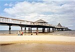
Heringsdorf is a semi-urban municipality and a popular seaside resort on Usedom Island in Western Pomerania, Germany. It is also known by the name Kaiserbad (English: Imperial Spa). The municipality was formed in January 2005 out of the former municipalities of Heringsdorf, Ahlbeck and Bansin. Until January 2006, the municipality was called Dreikaiserbäder, literally meaning Three Imperial Spas, a reference to several vacation visits of the German emperor Wilhelm II until 1918. For the same reason, the fine sandy beach stretching about 12 km (7.5 mi) from Bansin over Heringsdorf to Ahlbeck and Swinemünde (nowadays a Polish spa), is also called Kaiserstrand (Imperial Beach). The continuous Baltic Sea beach of Usedom Island has an overall length of exactly 40 km (25 mi) and an average width of 40 m (130 ft). Tourism is the dominant economical sector of the Imperial Spas, with an increasing number of hotels and vacation homes every year.

Excerpt from the Wikipedia article Heringsdorf (License: CC BY-SA 3.0, Authors, Images).

Heringsdorf
Küstengewässer einschließlich Anteil am Festlandsockel

Geographical coordinates (GPS) Address Nearby Places
placeShow on map

Wikipedia: HeringsdorfContinue reading on Wikipedia

Geographical coordinates (GPS)

Latitude Longitude
N 53.966666666667 ° E 14.166666666667 °
placeShow on map

Address

Küstengewässer einschließlich Anteil am Festlandsockel


18569 Küstengewässer einschließlich Anteil am Festlandsockel
Mecklenburg-Vorpommern, Germany
mapOpen on Google Maps

Heringsdorf Seeschloss
Share experience

Nearby Places

Oder–Neisse line
Oder–Neisse line

The Oder–Neisse line (German: Oder-Neiße-Grenze, Polish: granica na Odrze i Nysie Łużyckiej) is an unofficial term for the modern border between Germany and Poland. The line generally follows the Oder and Lusatian Neisse rivers, meeting the Baltic Sea in the north. A small portion of Polish territory does fall west of the line, including the cities of Szczecin and Świnoujście (German: Stettin and Swinemünde).All prewar German territories east of the line and within the 1937 German boundaries – comprising nearly one quarter (23.8 percent) of the Weimar Republic – were ceded under the changes decided at the Potsdam Conference, with the majority ceded to Poland. The remainder, consisting of northern East Prussia including the German city of Königsberg (renamed Kaliningrad), was allocated to the Soviet Union, as the Kaliningrad Oblast of the Russian SFSR (today Russia). Much of the German population in these territories – estimated at around 12 million in autumn 1944 – had fled in the wake of the Soviet Red Army's advance. The Oder–Neisse line marked the border between East Germany and Poland from 1950 to 1990. The two Communist governments agreed to the border in 1950, while West Germany, after a period of refusal, adhered to the border, with reservations, in 1972 (treaty signed with Poland in 1970).After the revolutions of 1989, newly reunified Germany and Poland accepted the line as their border in the 1990 German–Polish Border Treaty.