Grandpont
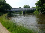
Grandpont is a mainly residential area in south Oxford. It is west of Abingdon Road, and consists mainly of narrow streets that run at right angles to the main road, with terraced late-Victorian and Edwardian houses. It also contains the Grandpont Nature Park—a riverside park managed by Oxford City Council (grid reference SP510054). The park covers 7.4 acres (3 ha) and was created in 1985 on the site of a gas works that was demolished in 1960. The former railway bridge, used to carry coal from the main railway line across the River Thames to the older gas works in St Ebbes on the north bank, still stands, and is in use as a footbridge. A later bridge, Grandpont Bridge, provides a more direct pedestrian and cycle route across the river to St Ebbes.
Excerpt from the Wikipedia article Grandpont (License: CC BY-SA 3.0, Authors).Grandpont
Whitehouse Road, Oxford South Oxford
Geographical coordinates (GPS) Address Nearby Places Show on map
Geographical coordinates (GPS)
| Latitude | Longitude |
|---|---|
| N 51.745 ° | E -1.263 ° |
Address
Whitehouse Road
OX1 4NG Oxford, South Oxford
England, United Kingdom
Open on Google Maps


