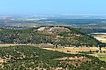
The Valley of Elah or Ella Valley ("the valley of the terebinth"; from the Hebrew: עמק האלה Emek HaElah), called in Arabic: وادي السنط, Wadi es-Sunt, so-named from its Acacia albida trees, is a long, shallow valley in the Levant best known as the place described in the Hebrew Bible (or Old Testament of Christianity) where the Israelites were encamped when David fought Goliath (1 Samuel 17:2; 1 Samuel 17:19). It is home to several important archaeological sites, including those identified as the ancient towns of Azekah and Socho (1 Samuel 17:1). Rising up from the valley on its extreme southeast end lies the hilltop ruin Adullam, and on its north lie the ruins of the ancient fortress city of Khirbet Qeiyafa, which is identified with the ancient town of Sha'araim (1 Samuel 17:52).
The valley is named in Hebrew after the large and shady terebinth trees (Pistacia atlantica) which are indigenous to it. On the west side of the valley, near Socho, there is a very large and ancient tree of this kind, 55 feet (17 m) in height with a trunk 17 feet (5.2 m) in circumference and a canopy at least 75 feet (23 m) in diameter. This tree is notable for being one of the largest terebinths in the area, and marks the upper end of the valley.Since the early 1970s, the valley has also contained a large satellite relay station, with an antenna farm containing some 120 satellite dishes of various sizes. From 2010 to 2014, the region around the valley was believed to be threatened by shale oil extraction through the CCR ground-heating process, with the Green Zionist Alliance and the grassroots group Save Adullam, among others, working to stop exploitation of the region. The plan was ultimately blocked in 2014 by a zoning committee decision. In July 2019, the Elah Valley came under the Israel Nature and Parks Authority, owing largely to its historical importance and the desire to curtail the encroaching city limits of Beit Shemesh to its north.


