place

Risinghurst

Areas of OxfordEngvarB from June 2016Housing estates in Oxfordshire

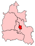
Risinghurst is an outlying residential area of Oxford, England, just outside the Eastern Bypass Road which forms part of the Oxford ring road. It is about 1 mile (1.6 km) east of the centre of Headington and 3 miles (4.8 km) east of Oxford city centre. It is part of the Risinghurst and Sandhills civil parish and is typical of housing estates built between the wars to house an increasingly prosperous working class who were moving into new urban centres—in this instance to take advantage of the burgeoning motor industry in Oxford.These estates offered decent housing, relatively sizeable gardens, a garage for a car and whilst Risinghurst isn't quite a garden city it has a sense of tranquillity (the countrification coming from the pebble-dash finish, the rough stone front wall, and a decent sized front garden where roses could be – and often were – grown). During the 1930s some 600 homes were built in sets of semi-detached units; two rows of shops were built on Downside Road and more at the end of Green Road in a stretch called The Roundway along with two pubs, a small library but neither a school nor, initially, a church. This left Risinghurst not quite a self-contained community and one that, by and large, was defined by 'The Works' (Morris Motors and Pressed Steel) that offered a broad range of amenities for their employees.

Excerpt from the Wikipedia article Risinghurst (License: CC BY-SA 3.0, Authors).

Risinghurst
Downside Road, Oxford Risinghurst and Sandhills

Geographical coordinates (GPS) Address Nearby Places
placeShow on map

Wikipedia: RisinghurstContinue reading on Wikipedia

Geographical coordinates (GPS)

Latitude Longitude
N 51.76 ° E -1.19 °
placeShow on map

Address

Downside Road 43
OX3 8HR Oxford, Risinghurst and Sandhills
England, United Kingdom
mapOpen on Google Maps

Share experience

Nearby Places

Old Road, Oxford
Old Road, Oxford

Old Road is a long street in Headington, east Oxford, England, extending into Oxfordshire as a road east of Oxford, to Littleworth near Wheatley. It is part of the main old road between Oxford and London until the late 18th century, passing over Shotover Hill. Nowadays it crosses the Oxford Ring Road (A4142) with a bridge. At the western end, Old Road connects with Warneford Lane, Gypsy Road, and Roosevelt Drive, close to Cheney School and the Warneford Hospital. Travelling east, the Nuffield Department of Orthopaedics, Rheumatology and Musculoskeletal Sciences (NDORMS) and Rock Edge Nature Reserve (including the old Rock Edge quarry site, a Site of Special Scientific Interest) are to the north, near the junction with Windmill Road (north) and The Slade (south). Passing across Eastern By-Pass Road (A4142, part of the Oxford Ring Road), the road passed through Shotover Country Park. The paved section of the road end in a car park next to Shotover Country Park, and the road continues largely as a dirt track until it reaches a small reservoir. At the eastern end, Old Road joins Littleworth Road in Littleworth on the outskirts of Wheatley. Due to the unpaved section, Old Road today acts as two separate roads, one on Oxford (and leading to Shotover Country Park just outside the city) and a shorter section being a de facto cul-de-sac in Littleworth. The Old Road Campus of Oxford University, to the south of Old Road, is named after the road.

Headington Quarry
Headington Quarry

Headington Quarry is a residential district of Oxford, England, located east of Headington and west of Risinghurst, just inside the Oxford ring road in the east of the city. To the south is Wood Farm. Today the district is also known colloquially as "Quarry". The area, now residential, is considerably uneven due to previous quarrying in the area. The Church of England parish church of the Holy Trinity was designed by George Gilbert Scott and built in 1848–49. The east window of its chancel was designed by Ninian Comper. The Friends of Holy Trinity Church was founded in 2002 to raise funds and look after the church. In 1930, C. S. Lewis, Oxford academic and author of The Chronicles of Narnia, and his brother Warnie moved, with Janie Moore and her daughter Maureen, into "The Kilns", a house on the outskirts of Headington Quarry. Lewis attended Holy Trinity Church. He first preached there on 29 March 1942, on the subject of "Religion and pleasure", and he is buried in the churchyard. There is a former Methodist Chapel in Quarry High Street. The Headington Quarry Morris Dancers are based in the area. Headington Quarry Morris Dancers were the first Morris dancers ever seen by Cecil Sharp, on Boxing Day 1899. This chance meeting was one of the events that sparked a lifelong interest in folk dance, song and music, to which Sharp devoted much of his life. Headington Quarry was designated a conservation area in 1971, and the Friends of Quarry is a residents' association which aims to preserve the distinctive character of the Conservation Area and its immediate neighbourhood.