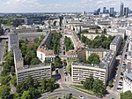
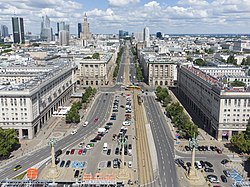
The South Downtown (Polish: Śródmieście Południowe) is a neighbourhood, and a City Information System area, in Warsaw, Poland, located within the Downtown district. It mostly consists of mid-rise residential area, predominantly made of tenements and multifamily residential buildings, as well as, to a lesser extent, office and commercial spaces.
The neighbourhood includes the housing estate of the Marshal Residential District, centred on the Marszałkowska Street, between Constitution and Saviour Squares, which was designed in the 1950s in the socialist realistic style. Near it is also the housing estate of Latawiec, built around the same time. There are also located numerous historical tenements, some dating to the late 19th and early 20th centuries. The two tallest skyscrapers in the area, designed in the International Style, are LIM Center and Chałubińskiego 8, with a total height of, respectively, 170 m and 150 m. South Downtown also includes large green spaces, including the Marshal Józef Piłsudski Park, a part of the Mokotów Field park complex, placed in the southwestern portion of the neighbourhood. Other parks in the area, located in the east, are the Marshal Edward Rydz-Śmigły Park, the Na Książęcem Park, and the Swiss Valley Park. There is also the Three Crosses Square. The neighbourhood also includes the campus and most faculty buildings of the Warsaw University of Technology, including its Main Building at the Polytechnic Square, which dates to 1901. Among the cultural institutions, there is Warsaw National Museum, the largest museum in the city, and one of the largest in the country, as well as Mausoleum of Struggle and Martyrdom and Museum of the Earth of the Polish Academy of Sciences. There are also located numerous theatres. The neighbourhood also includes three historical Roman Catholic churches, the Church of the Holiest Saviour, the St. Alexander Church, and the Saint Apostles Peter and Paul Church, that date to late 19th and early 20th century. South Downtown also houses the Seym and Senate Complex at Wiejska Street, that houses the Seym and Senate of the Parliament of Poland. There are also headquarters of numerous government ministries and agencies, as well as foreign embassies. Within the neighbourhood is present the Politechnika station of the M1 line of the Warsaw Metro.
Throughout the 18th century, in the area of modern South Downtown began developing small suburban towns of Warsaw agglomeration, including Bielino, Bożydar-Kałęczyn, and Nowogrodzka. Between 1768 and 1770, there was developed the Stanisław Axis, the urban layout made of five squares and roads, connecting the city with the Ujazdów Castle. The five squares were: Crossroads, Polytechnic, Saviour, Three Crosses, and Union of Lublin. In 1770, to the south of Warsaw agglomeration were aldo erected the fortification lines, known as the Lubomirski Ramparts, which surrounded the city. Union of Lublin Square became then one of the entrances to the city, and in 1818 there were erected the Mokotów Tollhouses. In 1776 alongside the Warsaw Escarpment were founded two garden complexes which would later form Na Książęcem Park and Frascati Gardens. In 1791, the area was incorporated into the city of Warsaw.
In 1825, at the Three Crosses Square was opened the St. Aleksander Church. In 1885, at Nowogrodzka Street, was also opened the Saint Apostles Peter and Paul Church. In 1887, at Polna Street, was opened the Mokotów Field Horce Race Track, that remained in use until 1938. The major development in the area of South Downtown begun in the second half of the 19th century, due to the construction of the Vienna Station in 1845. There begun being constructed luxury tenements, with restaurants, stores, and services. In 1898 there was founded the Warsaw University of Technology. In late the late 1890s, the area around Ujazdów Avenue, became a luxurious neighbourhood mostly inhabited by a wealthy Russian population. Following the retreat of the Imperial Russian Army from Warsaw in 1915, the Russian population mostly fled the city.
In 1909, at Koszykowa Street was opened a large market hall known as the Koszyki Hall. In 1910, at the Mokotów Field was established the first aerodrome in the city, known as the Mokotów Aerodrome. It became a base for growing military and civilian aviation industry and an international airfield. It remained operational until remained operational until 1947. In 1919 and 1922 respectively, two buildings at Wiejska Street were adopted to house the Legislative Seym and Senate of the Parliament of Poland. Between 1925 and 1935, they were furtherly expanded forming the Seym and Senate Complex. Between 1901 and 1927, next to the Saviour Square was constructed the Church of the Holiest Saviour. In 1925, the portion of the Frascati Gardens was sold of and replaced with a neighbourhood of villas, centred on Frascati Street. In the 1930s, it was further developed with luxury tenements. Between 1927 to 1938, at 3 Jerusalem Avenue, was constructed the building of the Warsaw National Museum. Until 2023, its eastern wing also housed the Polish Army Museum.
In 1939, while the city was under German occupation
during the Second World War, the section of South Downtown, centred on Szucha Avenue was turned into the Police District, a restricted area, thar housed the law enforcement organizations of the occupant government. This included the Security Police and the Gestapo (Secret State Police). Following the beginning of the Warsaw Uprising on 1 September 1944, the area became a battleground of German forces and Polish participants of the Home Army, including the unsuccessful and costly attack on the Police District. At Jerusalem Avenue was also erected a fortified barricade, which became an important line of communications of the partisans, that was held until the end of the uprising. During the conflict, German forces had committed numerous war crimes on the local civilian population, including executions at the building of the former General Inspector of the Armed Forces (currently the building of the Chancellery of the Prime Minister), with estimates of between five and ten thousand people being killed there. Following the capitulation of the uprising, the population was evicted, and a large portion of the city was raised to the ground.
This included South Downtown, which was already heavily destroyed during the conflict. The neighbourhood and many of its historical buildings were rebuilt after the war.
From 1950 to 1952, in the area along Marszałkowska Street, was built new housing estate of the Marshal Residential Distric. Its northern portion was centred on then-built Constitution Square. Between 1953 and 1957, it was expanded to the southeast, with the housing estate of Latawiec. In 1955, in the area of Warsaw Escarpment was opened the Marshal Edward Rydz-Śmigły Park, incorporating Na Książęcem Park and Frascati Gardens. In 1964, at Waryńskiego Street was opened skyscraper student dormitory Riviera, which became the second tallest building in the city, after the Palace of Culture and Science. It kept the title until 1969, and in 1974, it was again passed down to hotel skyscraper Novotel Warszawa Centrum built at Marszałkowska Street. In 1975, in the area of the crossing of Jerusalem Avenue and Chałubińskiego Street, begun the construction of the building complex of skyscrapers, multistorey stores and appartment buildings named the West Wall. It included two skyscrapers, Chałubińskiego 8 and LIM Center, opened respectively in 1975 and 1989. Upon the end of construction, both buildings held respectively the title of the second highest building in the city, with the latter keeping it until 1998. Throughout the 1970s and 1980s, the area of the former Mokotów Aerodrome was developed into a large urban park, known as the Mokotów Field. In 1995, in the neighbourhood was opened the Politechnika station of the Warsaw Metro.


