place

Fort Ethan Allen

1894 establishments in VermontBuildings and structures in Colchester, VermontBuildings and structures in Essex, VermontForts in VermontForts on the National Register of Historic Places
Historic districts in Chittenden County, VermontHistoric districts on the National Register of Historic Places in VermontNRHP infobox with nocatNational Register of Historic Places in Chittenden County, VermontWater towers on the National Register of Historic Places in Vermont
Fortethanallen
Fortethanallen

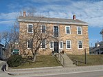
Fort Ethan Allen was a United States Army installation in Vermont, named for American Revolutionary War figure Ethan Allen. Established as a cavalry post in 1894 and closed in 1944, today it is the center of a designated national historic district straddling the town line between Colchester and Essex. Locally, it is known simply as "The Fort", and now houses a Vermont National Guard installation a variety of businesses, academic institutions, and residential areas.

Excerpt from the Wikipedia article Fort Ethan Allen (License: CC BY-SA 3.0, Authors, Images).

Fort Ethan Allen
Hegeman Avenue,

Geographical coordinates (GPS) Address Nearby Places
placeShow on map

Wikipedia: Fort Ethan AllenContinue reading on Wikipedia

Geographical coordinates (GPS)

Latitude Longitude
N 44.505555555556 ° E -73.150277777778 °
placeShow on map

Address

Hegeman Avenue 114
05446
Vermont, United States
mapOpen on Google Maps

Fortethanallen
Fortethanallen
Share experience

Nearby Places

Chittenden-3-9 Vermont Representative District, 2002–2012

The Chittenden-3-9 Representative District is a one-member state Representative district in the U.S. state of Vermont. It is one of the 108 one- or two-member districts into which the state was divided by the redistricting and reapportionment plan developed by the Vermont General Assembly following the 2000 U.S. Census. The plan applies to legislatures elected in 2002, 2004, 2006, 2008, and 2010. A new plan will be developed in 2012 following the 2010 U.S. Census. The Chittenden-3-9 District includes a section of the Chittenden County city of South Burlington defined as follows: That portion of the City of South Burlington starting at the junction of the Burlington-South Burlington boundary and Williston Road and following that boundary starting northerly following the city boundary to the Winooski River, then following the South Burlington-Winooski River boundary to Muddy Brook, then following the Muddy Brook-South Burlington boundary to Williston Road, then westerly to Hinesburg Road/Patchen Road, then southerly to Woodcrest Street, then westerly on Woodcrest Street, then northerly on Woodcrest Street, then westerly on Woodcrest Street, then southerly on Woodcrest Street to Dean Street, then easterly on Dean Street to Hinesburg Road, then continuing southerly on Hinesburg Road to Potash Brook, then westerly following the centerline of Potash Brook to the intersection with Kennedy Drive, then westerly on Kennedy Drive to Dorset Street, then northerly on Dorset Street to Williston Road, then westerly to the point beginning at the junction of the Burlington-South Burlington boundary and Williston Road. The rest of South Burlington is in Chittenden-3-7, Chittenden-3-8, and Chittenden-3-10. As of the 2000 census, the state as a whole had a population of 608,827. As there are a total of 150 representatives, there were 4,059 residents per representative (or 8,118 residents per two representatives). The one member Chittenden-3-9 District had a population of 3,714 in that same census, 8.5% below the state average.