place

Burlington International Airport

1920 establishments in VermontAirports established in 1920Airports in VermontBuildings and structures in South Burlington, VermontSouth Burlington, Vermont
Transportation buildings and structures in Chittenden County, VermontUse mdy dates from May 2014
BTV 2020 201x128
BTV 2020 201x128

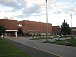
Burlington International Airport (IATA: BTV, ICAO: KBTV, FAA LID: BTV) is a joint-use civil-military airport serving Burlington, Vermont, the state of Vermont's largest municipality. It is owned by the City of Burlington and located in the neighboring city of South Burlington, three nautical miles (6 km) east of Burlington's central business district. About 40% of the airport's passengers come from Quebec.Federal Aviation Administration records show that the airport had 687,436 passenger boardings (enplanements) in calendar year 2019, up from 658,879 enplanements in 2018, an increase of 4.33%. This airport is included in the FAA's National Plan of Integrated Airport Systems for 2021–2025, which categorized it as a primary commercial service airport (more than 10,000 enplanements per year). It is by far the busiest airport in Vermont, with 100 times the traffic of the second-busiest, Rutland–Southern Vermont Regional Airport. Although Rutland–Southern Vermont Regional Airport also provides commercial service, BTV is the only airport in the state with significant commercial service. The airport serves as the base of the 158th Fighter Wing, Vermont Air National Guard and an Army Aviation Support Facility (AASF) of the Vermont Army National Guard and the Vermont State Guard.

Excerpt from the Wikipedia article Burlington International Airport (License: CC BY-SA 3.0, Authors, Images).

Burlington International Airport
Airport Drive, South Burlington

Geographical coordinates (GPS) Address External links Nearby Places
placeShow on map

Wikipedia: Burlington International AirportContinue reading on Wikipedia

Geographical coordinates (GPS)

Latitude Longitude
N 44.471944444444 ° E -73.153333333333 °
placeShow on map

Address

Burlington International Airport

Airport Drive
05403 South Burlington
Vermont, United States
mapOpen on Google Maps

linkWikiData (Q2750047)
linkOpenStreetMap (28011789)

BTV 2020 201x128
BTV 2020 201x128
Share experience

Nearby Places

Chittenden-3-9 Vermont Representative District, 2002–2012

The Chittenden-3-9 Representative District is a one-member state Representative district in the U.S. state of Vermont. It is one of the 108 one- or two-member districts into which the state was divided by the redistricting and reapportionment plan developed by the Vermont General Assembly following the 2000 U.S. Census. The plan applies to legislatures elected in 2002, 2004, 2006, 2008, and 2010. A new plan will be developed in 2012 following the 2010 U.S. Census. The Chittenden-3-9 District includes a section of the Chittenden County city of South Burlington defined as follows: That portion of the City of South Burlington starting at the junction of the Burlington-South Burlington boundary and Williston Road and following that boundary starting northerly following the city boundary to the Winooski River, then following the South Burlington-Winooski River boundary to Muddy Brook, then following the Muddy Brook-South Burlington boundary to Williston Road, then westerly to Hinesburg Road/Patchen Road, then southerly to Woodcrest Street, then westerly on Woodcrest Street, then northerly on Woodcrest Street, then westerly on Woodcrest Street, then southerly on Woodcrest Street to Dean Street, then easterly on Dean Street to Hinesburg Road, then continuing southerly on Hinesburg Road to Potash Brook, then westerly following the centerline of Potash Brook to the intersection with Kennedy Drive, then westerly on Kennedy Drive to Dorset Street, then northerly on Dorset Street to Williston Road, then westerly to the point beginning at the junction of the Burlington-South Burlington boundary and Williston Road. The rest of South Burlington is in Chittenden-3-7, Chittenden-3-8, and Chittenden-3-10. As of the 2000 census, the state as a whole had a population of 608,827. As there are a total of 150 representatives, there were 4,059 residents per representative (or 8,118 residents per two representatives). The one member Chittenden-3-9 District had a population of 3,714 in that same census, 8.5% below the state average.