place

Lyons, Australian Capital Territory
Suburbs of CanberraUse Australian English from March 2018
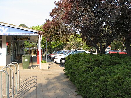
Lyons shops
Lyons shops

Lyons is a suburb in the Canberra, Australia district of Woden. The postcode is 2606. The suburb was named after Joseph Lyons, Labor Premier of Tasmania from 1923 to 1928 and a Minister in the James Scullin government from 1929 until his resignation from the Labor Party in March 1931. He subsequently led the United Australia Party and was the tenth Prime Minister of Australia from January 1932 until his death in 1939. The suburb is bounded by Melrose Drive, Tuggeranong Parkway and Hindmarsh Drive. Oakey Hill Nature Reserve, part of Canberra Nature Park, is located within the suburb. The reserve has a number of walking trails and views across Woden and Weston Creek and into Civic. The suburb has a local shopping centre and neighbourhood oval. A former petrol station has since been demolished. Lyons Early Learning School caters for children from birth to grade two through an on-site childcare provider amalgamated with the school.Streets in Lyons are named after locations in Tasmania.

Excerpt from the Wikipedia article Lyons, Australian Capital Territory (License: CC BY-SA 3.0, Authors, Images).

Lyons, Australian Capital Territory
Tarraleah Crescent,

Geographical coordinates (GPS) Address Nearby Places
placeShow on map

Wikipedia: Lyons, Australian Capital TerritoryContinue reading on Wikipedia

Geographical coordinates (GPS)

Latitude Longitude
N -35.342 ° E 149.076 °
placeShow on map

Address

Tarraleah Crescent

Tarraleah Crescent
2606 , Lyons
Australia
mapOpen on Google Maps

Lyons shops
Lyons shops
Share experience

Nearby Places

Phillip, Australian Capital Territory

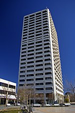
Phillip (postcode: 2606) is a suburb of Canberra, Australia in the district of Woden Valley. It is located in the centre of the district and contains the district's main commercial centre, Woden Town Centre. Phillip had a residential population of 5,197 at the 2021 census. 67.0% of the population lived in flats. Many more flats are being planned or built. The suburb is named after Arthur Phillip, the first Governor of New South Wales. The suburb name was gazetted on 12 May 1966. Streets in Phillip use names associated with the First, Second and Third Fleets; streets in the Swinger Hill were named after architects.As the commercial and geographical centre of Woden, Phillip contains many of the district's key facilities. As well as the Woden Town Centre, which includes the Westfield Woden shopping centre, a bus interchange and the Lovett Tower (the tallest commercial office building in Canberra), it has its own commercial area located along Botany, Townshend and Parramatta Streets. Eddison Park, including Woden Skate Park and Disc Golf Course, and the Woden Cemetery are located in the suburb. Phillip also contains a number of sporting facilities, including the Phillip Enclosed Oval, which has been known as Football Park since 1981 and was the headquarters of Australian rules football in Canberra during the 1980s and 1990s, and the Phillip Swimming & Ice Skating Centre, home to the CBR Brave of the Australian Ice Hockey League. The Canberra College is situated in Phillip.

Curtin, Australian Capital Territory

Curtin () is a suburb in Canberra, Australia, part of the Woden Valley district; its postcode is 2605. Curtin is named after John Curtin, Australian Prime Minister between 1941 and 1945. Its streets are named after state premiers.It is next to the suburbs of Yarralumla, Deakin, Hughes, Lyons and Weston. It is bounded by the Cotter Road, Tuggeranong Parkway, Yarra Glen and a green strip between it and Lyons to the south. Curtin shopping centre offers the following services: Coles supermarket, post office, newsagent, bank, real estate agent, chemist, hairdresser, barber, travel agent, optometrist, florist, bakery, greengrocer and numerous cafes and coffee shops. Of note is the Curtin Milk Bar which was the longest running cafe in the area. Its style and operation remained unchanged since the 1970s until its closure in December 2017. Nearby is Curtin Scout Hall. Areas of Curtin were designed in accordance with the Radburn model of suburban design and public housing. In Australia, the Radburn model was used in the planning of some Canberra suburbs developed in the 1960s, in particular Charnwood, Curtin and Garran, and a small part of Hughes. These pockets of Radburn design have not seen the same anti-social and crime-related problems that have plagued similar areas in Western and South-Western Sydney, such as Mt Druitt. The Canberra bushfires of 2003 destroyed four Curtin homes and caused damage to others. The Emergency Services Bureau, based in Curtin, which was the centre of command for the firefighting operation, came under threat itself when its roof caught fire. The suburb celebrated the fiftieth anniversary of the arrival of its first residents in 2014. As part of that celebration, the Canberra & District Historical Society, which is headquartered at the shops, helped local residents to record oral histories of their memories. They can be accessed on a Web site called Curtin Living Memories. Residents subsequently compiled and published a book on life in the suburb called, Curtin Turns 50.