Gungahlin, Australian Capital Territory
Suburbs of CanberraUse Australian English from March 2018

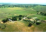
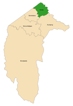
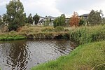
Gungahlin is a suburb in the Canberra, Australia district with the same name; Gungahlin. The postcode is 2912. Gungahlin is the name for the entire district, and also the town centre, but it is also the name of the suburb which Gungahlin Town Centre is in. It is next to the suburbs of Ngunnawal, Palmerston, Franklin, Harrison, Throsby, Forde and Amaroo. Burgmann Anglican School is located in the suburb. The edges of the suburb are on Horse Park Drive, Gundaroo Drive and Gungahlin Drive.
Excerpt from the Wikipedia article Gungahlin, Australian Capital Territory (License: CC BY-SA 3.0, Authors, Images).Gungahlin, Australian Capital Territory
Efkarpidis Street,
Geographical coordinates (GPS) Address Website Nearby Places Show on map
Geographical coordinates (GPS)
| Latitude | Longitude |
|---|---|
| N -35.18335 ° | E 149.13185 ° |
Address
Abode - The Apartment Hotel
Efkarpidis Street 15
2912 , Gungahlin
Australia
Open on Google Maps


