Békásmegyer

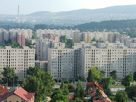
Békásmegyer (German: Krottendorf) is a neighbourhood in Budapest, Hungary. It belongs administratively to District III. Békásmegyer consists of two different parts, a huge high-rise housing estate and the traditional Ófalu ("Old Village") with older houses. Békásmegyer is divided into two by the Szentendre HÉV line. Békásmegyer bal-oldal or hegy felőli oldal (left-side or mountain side) and Békásmegyer jobb-oldal or Duna felőli oldal (right-side or Danube side). The left side was an independent village until 1 January 1950, when it was merged into Budapest, while the right side was a water reservoir of the Danube river. Today 41,000 people live in Békásmegyer Microdistrict (13,394 panel flats) and a few thousand in the former village.
Excerpt from the Wikipedia article Békásmegyer (License: CC BY-SA 3.0, Authors, Images).Békásmegyer
Bebo Károly utca, Budapest Békásmegyer
Geographical coordinates (GPS) Address Nearby Places Show on map
Geographical coordinates (GPS)
| Latitude | Longitude |
|---|---|
| N 47.6 ° | E 19.05 ° |
Address
Bebo Károly utca
Bebo Károly utca
1039 Budapest, Békásmegyer
Hungary
Open on Google Maps


