place

West Felton

Civil parishes in ShropshireShropshire geography stubsSource attributionVillages in Shropshire
St Michael's Church, West Felton geograph.org.uk 1188162

West Felton is a village and civil parish near Oswestry in Shropshire, England. At the 2001 census the parish, which also includes the settlements of Rednal, Grimpo and Haughton, had a population of 1,380, increasing to 1,475 at the 2011 Census.

Excerpt from the Wikipedia article West Felton (License: CC BY-SA 3.0, Authors, Images).

West Felton
Holyhead Road,

Geographical coordinates (GPS) Address Nearby Places
placeShow on map

Wikipedia: West FeltonContinue reading on Wikipedia

Geographical coordinates (GPS)

Latitude Longitude
N 52.824 ° E -2.971 °
placeShow on map

Address

Holyhead Road

Holyhead Road
SY11 4EL , West Felton
England, United Kingdom
mapOpen on Google Maps

St Michael's Church, West Felton geograph.org.uk 1188162
Share experience

Nearby Places

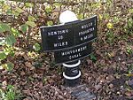
Montgomery Canal
Montgomery Canal

The Montgomery Canal (Welsh: Camlas Trefaldwyn), known colloquially as "The Monty", is a partially restored canal in eastern Powys and northwest Shropshire. The canal runs 33 miles (53 km) from the Llangollen Canal at Frankton Junction to Newtown via Llanymynech and Welshpool and crosses the England–Wales border. Originally, the canal from Llanymynech to Newtown was known as the Montgomeryshire Canal. It was named after the county of Montgomeryshire that it ran through and it was divided into Western and Eastern branches which met at Garthmyl. At Carreghofa Locks near Llanymynech, the Montgomeryshire Canal connected to the Llanymynech Branch of the Ellesmere Canal. These elements of the present-day Montgomery Canal were unified when they each became part of the Shropshire Union system: the Ellesmere Canal in 1846, the Eastern Branch in 1847 and the Western Branch in 1850. The canal fell into disuse following a breach in 1936 and was officially abandoned in 1944. With the revival of canal use in the late 20th century, the Western and Eastern branches of the Montgomeryshire Canal and the Llanymynech Branch of the Ellesmere Canal together became known as the Montgomery Canal although the canal does not, and never did, go to the town of Montgomery. At present only 7 miles (11 km) from Frankton Junction to Gronwen Wharf is navigable and connected to the rest of the national Canal & River Trust network. Separately, a short stretch at Llanymynech and a central section of the canal around Welshpool are also navigable though isolated from the national canal network. Ongoing restoration work continues to expand the navigable sections.