Broom, South Yorkshire
South Yorkshire geography stubsUse British English from November 2020Villages in South Yorkshire

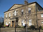
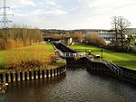
Broom (historically sometimes spelled "Broome") is a village in South Yorkshire, England and is located in the former parish of Whiston about 1 mile (2 km) southeast of Rotherham. Broom sits on top of a former Roman fortification and was the site of a Saxon trading town. The village currently has a population of 900. The town supports three pubs, a football club, Broom United, and numerous other small businesses.
Excerpt from the Wikipedia article Broom, South Yorkshire (License: CC BY-SA 3.0, Authors, Images).Broom, South Yorkshire
Wickersley Road,
Geographical coordinates (GPS) Address Nearby Places Show on map
Geographical coordinates (GPS)
| Latitude | Longitude |
|---|---|
| N 53.42 ° | E -1.33 ° |
Address
Wickersley Road
Wickersley Road
S60 3PX , Herringthorpe
England, United Kingdom
Open on Google Maps


