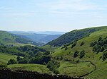
Cwmtillery
AbertilleryVillages in Blaenau GwentWards of Blaenau Gwent

Cwmtillery (from Welsh Cwmtyleri) (population 2011. 4800) is a ward of Abertillery. Located within the historic boundaries of Monmouthshire, it is part of the administrative area of the county borough of Blaenau Gwent, Wales.
Excerpt from the Wikipedia article Cwmtillery (License: CC BY-SA 3.0, Authors, Images).Cwmtillery
Victoria Street,
Geographical coordinates (GPS) Address Nearby Places Show on map
Geographical coordinates (GPS)
| Latitude | Longitude |
|---|---|
| N 51.7426 ° | E -3.1383 ° |
Address
Victoria Street
Victoria Street
NP13 1RE , Abertillery
Wales, United Kingdom
Open on Google Maps


