place

Romsley, Shropshire

Civil parishes in ShropshireHamlets in Shropshire
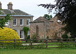
Red Lion View geograph.org.uk 447234

Romsley (grid reference SO783826) is a hamlet and civil parish in southeast Shropshire, England. It is bounded on the north and west by Alveley and on the south by Upper Arley in Worcestershire. On its short eastern boundary it meets Compton on Kinver. It is a dispersed settlement and there is no church in the parish. The parish is mainly a farming community, comprising only 36 houses in 1961.

Excerpt from the Wikipedia article Romsley, Shropshire (License: CC BY-SA 3.0, Authors, Images).

Romsley, Shropshire
Romsley Lane,

Geographical coordinates (GPS) Address Nearby Places
placeShow on map

Wikipedia: Romsley, ShropshireContinue reading on Wikipedia

Geographical coordinates (GPS)

Latitude Longitude
N 52.446 ° E -2.324 °
placeShow on map

Address

Romsley Lane

Romsley Lane
WV15 6HJ
England, United Kingdom
mapOpen on Google Maps

Red Lion View geograph.org.uk 447234
Share experience

Nearby Places

Shatterford Hill
Shatterford Hill

Shatterford Hill is an English geographical feature that extends from Bewdley in north Worcestershire to Birdsgreen near Alveley, just over the border in Shropshire. The hill is a long ridge running up the east side of the Severn Valley and peaks at 202 metres near the village of Shatterford on the A442 road between Kidderminster and Bridgnorth. The ridge offers unhindered views across the Severn Valley out west to the Clee Hills, Caer Caradoc, the Long Mynd and on clear days to the hills of Wales. To the east is Kidderminster and the Clent Hills, and the urban West Midlands areas of Dudley beyond. To the north the Wrekin dominates the horizon near Telford, whilst to the south are the Malvern Hills. Although the triangulation pillar that officially marks the summit of the hill is in a field with no public access, next to a small mast, a viewpoint is provided on the Shatterford-Trimpley road with a small layby opposite. Villages along the hill include (south to north), Trimpley, Shatterford and Romsley. The road following the crown of the ridge was probably the Micclan strete (great made-road), mentioned in the Anglo-Saxon bounds of Wolverley. This may have been part of an ancient road from Gloucester and Worcester to Chester. From Shatterford through Romsley and Quatt, thus became part of the Kidderminster to Bridgnorth turnpike, until an easier road (now A442) was built in the 1830s.The ridge comes to a fairly abrupt end to the south, capped by Wassell Wood, where earthworks can still be seen from fortified enclosure of unknown date. The name "Wassell" is derived from the Anglo-Saxon "Weardsetl" meaning a watchplace. This was the westernmost of a chain of such watchplaces, also including Wassell Grove (near Wychbury Hill), Waseley Hills and Wast Hills in Alvechurch.Below Wassell Wood to the east is Habberley Valley, a local nature reserve of lowland heathland, which is a popular picnic site locally.

West Midlands (region)

The West Midlands is one of nine official regions of England at the first level of International Territorial Level for statistical purposes. It covers the western half of the area traditionally known as the Midlands. The region consists of the counties of Herefordshire, Shropshire, Staffordshire, Warwickshire, West Midlands and Worcestershire. The region has seven cities; Birmingham, Coventry, Hereford, Lichfield, Stoke-on-Trent, Wolverhampton and Worcester. The West Midlands region is geographically diverse, from the urban central areas of the West Midlands conurbation to the rural counties of Herefordshire, Shropshire and Worcestershire which border Wales. The region is landlocked. However, the longest river in the UK, the River Severn, traverses the region southeastwards, flowing through the county towns of Shrewsbury and Worcester, and the Ironbridge Gorge, a UNESCO World Heritage Site. Staffordshire is home to the industrialised Potteries conurbation, including the city of Stoke-on-Trent, and the Staffordshire Moorlands area, which borders the southeastern Peak District National Park near Leek. The region also encompasses five Areas of Outstanding Natural Beauty, the Wye Valley, Shropshire Hills, Cannock Chase, Malvern Hills, and parts of the Cotswolds. Warwickshire is home to the towns of Stratford upon Avon, birthplace of writer William Shakespeare, Rugby, the birthplace of Rugby football and Nuneaton, birthplace to author George Eliot.