place

Bradford (CDP), Vermont

Bradford, VermontCensus-designated places in Orange County, VermontCensus-designated places in VermontFormer municipalities in VermontHistoric districts on the National Register of Historic Places in Vermont
National Register of Historic Places in Orange County, VermontPopulated places disestablished in 2004Use mdy dates from July 2023
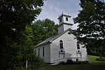
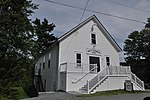
Woods Library and Hotel Low, Bradford, VT

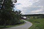
Bradford is a census-designated places in the town of Bradford, Orange County, Vermont, United States. The population was 907 at the 2020 census. The village disincorporated on December 1, 2004. The village became a census-designated place in 2008. The central commercial and residential portion of the village is listed on the National Register of Historic Places as the Bradford Village Historic District.

Excerpt from the Wikipedia article Bradford (CDP), Vermont (License: CC BY-SA 3.0, Authors, Images).

Bradford (CDP), Vermont
South Main Street,

Geographical coordinates (GPS) Address Phone number Website Nearby Places
placeShow on map

Wikipedia: Bradford (CDP), VermontContinue reading on Wikipedia

Geographical coordinates (GPS)

Latitude Longitude
N 43.992777777778 ° E -72.128611111111 °
placeShow on map

Address

Bradford Public Library

South Main Street 21
05033
Vermont, United States
mapOpen on Google Maps

Phone number

call+18022224536

Website
bradfordvtlibrary.org

linkVisit website

Woods Library and Hotel Low, Bradford, VT
Share experience

Nearby Places

Piermont Bridge
Piermont Bridge

The Piermont Bridge carries New Hampshire Route 25 over the Connecticut River to the contiguous Vermont Route 25 between Piermont, New Hampshire and Bradford, Vermont. It is a Pennsylvania steel through truss bridge, built by the Boston Bridge Works in 1928. The bridge consists of a single span with a clear span of 352' and an overall length of 354'10". The roadbed is 20'7" wide, with a vertical clearance of 14'7". The bridge is approximately 25' above the river. The western (Vermont) abutment is made of split granite quarried from nearby Fairlee Mountain, while the eastern abutment is an early concrete construction built in 1908 by John Storrs for an earlier bridge. The bridge underwent a major renovation in 1993 which included the addition of a sidewalk (under which utilities were laid) and replacement of much of the bridge decking.The bridge was built in the aftermath of major rain and flooding in 1927 along the Connecticut River, which washed away several bridges and caused significant damage in Vermont. The Piermont Bridge was the longest bridge built after this flooding, replacing a c. 1875 two-span Town lattice truss bridge. The center pier of the older bridge was knocked down to the water line and is still visible. The eastern abutment, built in 1908 in a relatively early use of structural concrete, needed to be strengthened to accommodate the increased weight of the new steel bridge. This was accomplished by adding new concrete to the land side of the abutment, preserving the earlier work.The bridge was listed on the National Register of Historic Places in 2001. It is owned by the states of New Hampshire (90%) and Vermont (10%).