place

Southland Park, Louisville

Jefferson County, Kentucky geography stubsLouisville, Kentucky stubsNeighborhoods in Louisville, Kentucky

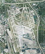
Southland Park is a neighborhood in Louisville, Kentucky, United States. Its boundaries are Southside Drive to the west, the Greater Louisville Technology Park (formerly Naval Ordnance) to the north, the CSX railroad tracks to the east, and the pre-merger Louisville city limits to the south.

Excerpt from the Wikipedia article Southland Park, Louisville (License: CC BY-SA 3.0, Authors).

Southland Park, Louisville
Strawberry Lane, Louisville

Geographical coordinates (GPS) Address Nearby Places
placeShow on map

Wikipedia: Southland Park, LouisvilleContinue reading on Wikipedia

Geographical coordinates (GPS)

Latitude Longitude
N 38.162222222222 ° E -85.758888888889 °
placeShow on map

Address

Strawberry Lane 6339
40214 Louisville
Kentucky, United States
mapOpen on Google Maps

Share experience

Nearby Places

Beechmont, Louisville

Beechmont is a neighborhood in the south end of Louisville, Kentucky. Its modern boundaries are I-264 to the north, Taylor Boulevard to the west, Southern Parkway and Southland Boulevard to the south, and Third Street, Allmond and Louisville Avenues to the east. Iroquois Park is located to its southwest. The park, purchased by Louisville Mayor Charles Donald Jacob in 1889 and completed in 1893, was connected to the city by Southern Parkway (originally called Grand Boulevard), in a master plan designed by Frederick Law Olmsted. Much like Shawnee Park spurred development in the Shawnee neighborhood, Iroquois Park contributed to making Beechmont a desirable suburb as it was developed in the 1890s. The neighborhood was named for the beech trees in the area, as Beechmont was to be a pleasant escape from the crowded urban area of Louisville. Due to its relative distance from Louisville, it was originally intended as a summer neighborhood for the wealthy, and was a part of the city of Highland Park - which incorporated in 1890. The dominant architectural style of early houses in the neighborhood is the Craftsman style. It was linked to Louisville by a streetcar line along 4th street in 1900, and the city was annexed by Louisville in 1922, after a 5-year court battle. Beechmont escaped flooding during the Great Flood of 1937, and was a temporary disaster shelter. The neighborhood expanded slightly as new developments were built after World War II. These developments were often unpopular with the residents of Beechmont. The neighborhood suffered a decline in the 1960s, following the same pattern as all of the older neighborhoods. As of 2000, Beechmont had a population of 8,021.[1]

Highland Park, Louisville

Highland Park was a city near and eventually neighborhood in Louisville, Kentucky, United States, that was razed as a part of the expansion of Louisville International Airport. Its boundaries were roughly the CSX railroad tracks to the west, and what would become the Kentucky State Fair & Exposition Center and the airport on all other sides (initially these were farm land). Highland Park was originally built largely for workers at the nearby Louisville & Nashville Railroad yard, with professor and businessman T. C. H. Vance laying out streets in the 1880s. Its relatively common name was based on its elevated location in relation to surrounding areas, particularly Louisville. Vance's daughter gave the streets their Indian-themed names, such as Hiawatha and Wampum, which was a fashionable practice at the time. Highland Park incorporated as a city in 1890, and grew quickly to 323 families by 1900. The city would grow to include Beechmont and Wilder Park, before all were annexed by Louisville in 1922, after a 5-year court battle. While initially centered on Louisville Avenue, the city and neighborhood's main commercial district eventually became Park Boulevard, especially after a streetcar line was installed there in 1920. Much of the neighborhood was razed to make way for the Watterson Expressway after World War II and all of it was finally razed in the early 1990s as a part of airport expansion, a plan first announced in 1987. However, most of what was once Highland Park is now vacant, and has not been developed by the airport. The street pattern remains intact, but areas where houses once stood have been fenced off. In 2009, the Regional Airport Authority, which owns the former Highland Park land, released plans to develop the land and re-route Crittenden Drive around it.James Russell Lowell Elementary School was built in 1916 in Highland Park, at that time outside the Louisville city limits. It was known as the East Highland Park School. It was expanded in 1931 and demolished in 1993.

Louisville International Airport

Louisville Muhammad Ali International Airport (IATA: SDF, ICAO: KSDF, FAA LID: SDF), formerly known as simply Louisville International Airport, is a civil-military airport in Louisville in Jefferson County, Kentucky. The airport covers 1,500 acres (6.1 km2) and has three runways. Its IATA airport code, SDF, is based on the airport's former name, Standiford Field. Despite being called an international airport, it has no regularly-scheduled international passenger flights, but is a port of entry, handling many UPS Airlines international cargo flights through the United Parcel Service's worldwide air hub, often referred to as UPS Worldport.Over 4.2 million passengers and over 5.7 billion pounds (2.89 million tons) of cargo passed through the airport in 2019. It is also the second-busiest in the United States in terms of cargo traffic, and fourth-busiest for such in the world. The National Plan of Integrated Airport Systems for 2011–2015 categorized it as a "primary commercial service" airport since it has over 10,000 passenger boardings (enplanements) per year. Federal Aviation Administration records show the airport had 1,877,861 revenue enplanements in 2018, an increase of 11.46% from 1,684,738 in 2017.Because of UPS Airlines' operations, Louisville International Airport is the second-busiest cargo airport in the United States, only falling short of FedEx's SuperHub at Memphis International Airport, and also the world's fourth-busiest airport by cargo traffic, behind Shanghai Pudong, Memphis and Hong Kong. The Kentucky Air National Guard's 123d Airlift Wing operates C-130 transport aircraft from the co-located Louisville Air National Guard Base. On January 16, 2019, the Regional Airport Authority voted to change the name of the airport to Louisville Muhammad Ali International Airport in honor of the boxer and Louisville native Muhammad Ali. On June 6, 2019, the airport unveiled its new logo, featuring "Ali's silhouette, arms up and victorious, against the background of a butterfly."