Tonge, Bolton
Areas of Bolton
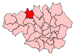
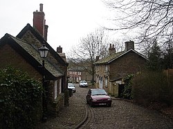
Tonge is an outlying area of Bolton, in Greater Manchester, England. The name is supposed to be derived from the Old English "tang" or "twang" meaning a fork in a river. Tonge comprises two areas, namely Tonge Fold and Tonge Moor. Tonge Fold sits upon the River Tonge, a region of whose banks are a geological site of special scientific interest (SSSI).Historically a part of Lancashire, it was once part of the township of Tonge with Haulgh. By the end of the 19th century Tonge was home to a coal mine.
Excerpt from the Wikipedia article Tonge, Bolton (License: CC BY-SA 3.0, Authors).Tonge, Bolton
Bury Road,
Geographical coordinates (GPS) Address Nearby Places Show on map
Geographical coordinates (GPS)
| Latitude | Longitude |
|---|---|
| N 53.580563 ° | E -2.405073 ° |
Address
Bury Road
Bury Road
BL2 6BB , Tonge Fold
England, United Kingdom
Open on Google Maps


