Tai Ho Wan

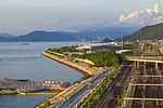
Tai Ho Wan (Chinese: 大蠔灣; Cantonese Yale: daaih hòh wāan; lit. 'big oyster bay', also 大濠灣; 'big inlet bay') is a bay on the north shore of Lantau Island in the New Territories of Hong Kong. It is located west of Siu Ho Wan, and northeast of Tung Chung and Kei Tau Kok. The surrounding land was originally planned to be part of the North Lantau New Town scope, but there is a current slowdown in its plans because of the lack in population growth and environmental groups opposed to the next in abeyance. Tai Ho was originally a rural area, to the northern part there is a shoal extend and to the southern part is the foot of Lin Fa Shan. Slopes are covered with grassland and shrub forests. There are monsoonal nature of swamps, as well as a stream named Tai Ho Stream which flows into the Tai Ho Bay.
Excerpt from the Wikipedia article Tai Ho Wan (License: CC BY-SA 3.0, Authors, Images).Tai Ho Wan
Shun Long Road, Islands District
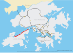
Geographical coordinates (GPS) Address Nearby Places Show on map
 Continue reading on Wikipedia
 Geographical coordinates (GPS)
| Latitude | Longitude |
|---|---|
| N 22.299266 ° | E 113.97826 ° |
Address
順朗路 Shun Long Road
Shun Long Road
Islands District
Hong Kong, China
Open on Google Maps