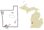
Park Township Airport
Park Township Airport (IATA: HLM, ICAO: KHLM, FAA LID: HLM) was a public airport located in Park Township, 3 mi (5 km) northwest of Holland, Michigan, United States. Built in 1937, the airport was operated by Ottawa Aviation, an organization of local users whose aim was to promote the value of the airport to the surrounding community. The airport had a main paved runway (5/23) that was demolished around August 15, 2020, and an intersecting grass runway (12/30) that still exists today. With the failure of a millage, the airport no longer supports fixed wing aircraft.The airport was used for general aviation and had no regularly scheduled commercial flights. It was quite popular with ultralight and model aircraft. The airport was also home to the Experimental Aircraft Association Chapter 1242.
Excerpt from the Wikipedia article Park Township Airport (License: CC BY-SA 3.0, Authors).Park Township Airport
152nd Avenue, Holland
Geographical coordinates (GPS) Address Nearby Places Show on map
 Continue reading on Wikipedia
 Geographical coordinates (GPS)
| Latitude | Longitude |
|---|---|
| N 42.795833333333 ° | E -86.161944444444 ° |
Address
Outdoor Discovery Center
152nd Avenue 30
49424 Holland
Michigan, United States
Open on Google Maps